Rothenburg Pilgrimage

Journey into the Heart of the German Countryside – Part I

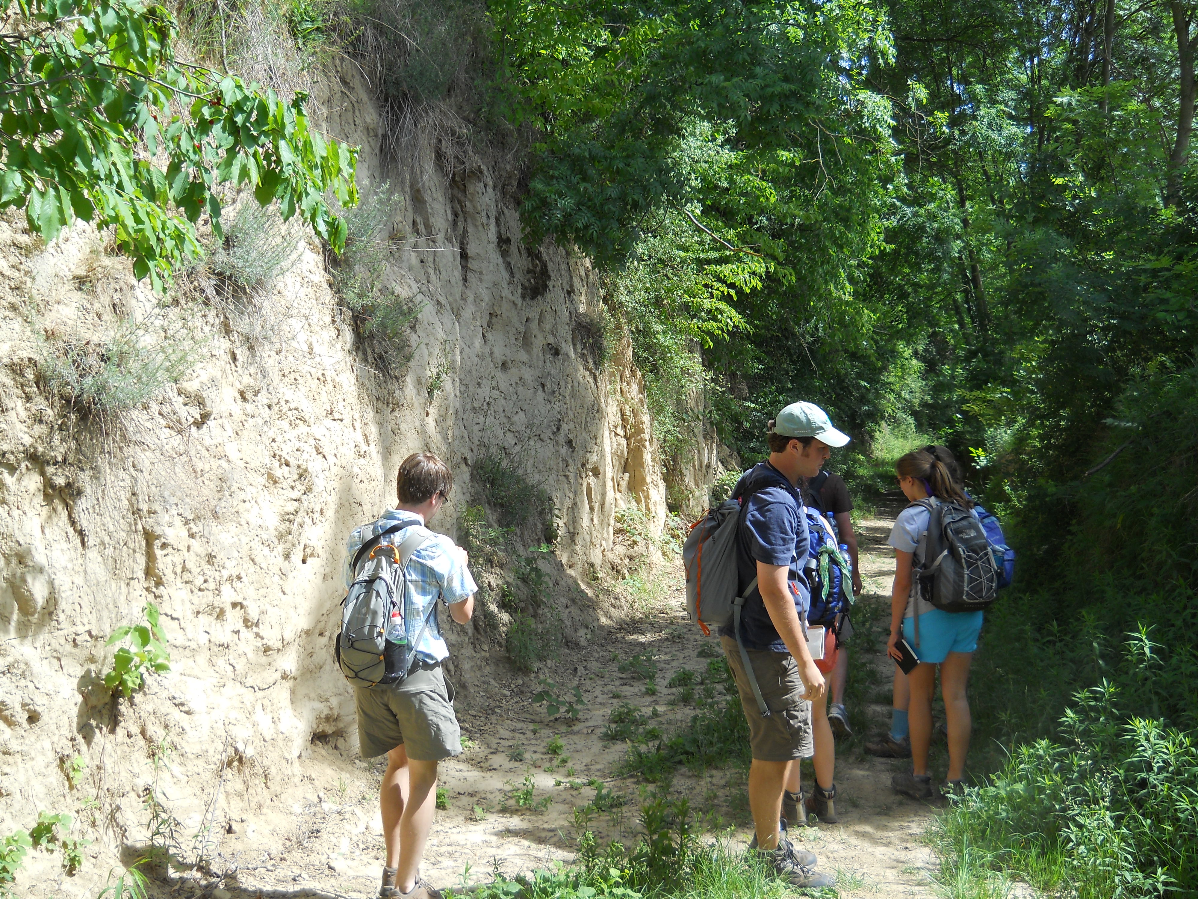
In the US we take great pride in our freedoms, often falsely thinking that they don’t exist in other lands. Or, not realizing that some freedoms may be greater in other countries. So it goes with freedom of mobility on foot. Try walking a 100 mile stretch in the US not located in some kind of state or federal park or preserve. It would mean walking the shoulder of a road, slave to the yellow line, in order to avoid trespassing. In Germany roads and tracks dissect field and forest and are all public access. This opens the geography to the hiker in such a way as to provide for dozens of potential routes to choose from between towns. Combine this with meticulously made German hiking maps and the possibilities for walking become endless.

IMG_1132
Typical German hiking map. Green, red, black and white lines are all hiking tracks.

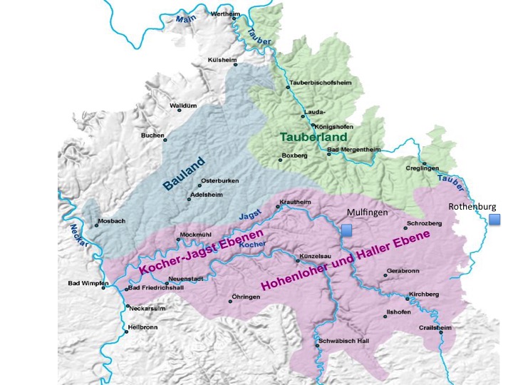
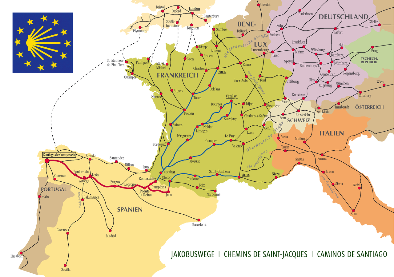
I had planned a 120 mile trek beginning in the town of Wiesloch on the western edge of the Kraichgau and ending at the medieval city of Rothenburg ob der Tauber. For weeks my dining room table was off-and-on covered with four hiking maps that spanned this stretch. With the aid of Google Earth I was able to plot a six day route with stays at taverns at the end of each day. At the end of my planning I discovered that my exact route was actually an ancient pilgrimage route – the Jakobsweg – between Rothenburg and the city of Speyer on the Rhine plain. The feet of ancient pilgrims had upstaged my clever cartographical analysis of the land.

pilgerweg_gesamt
I would join the Jakobsweg at Wiesloch, just north of Malsch on the map.

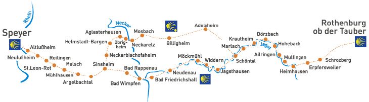
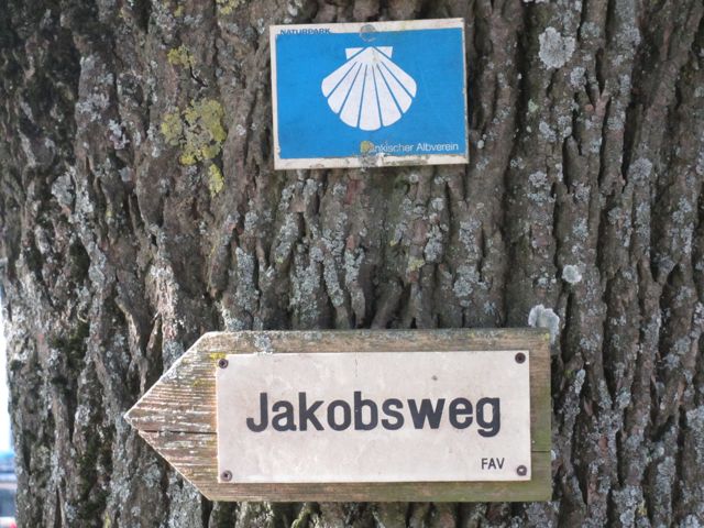
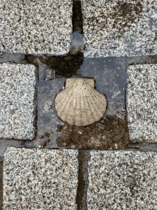
This route is part of a vast web of pilgrimage trails that converge on the grave of the apostle Jacob in Santiago de Compostela in Spain. Since the Middle Ages the shell has been the symbol of the traveller on these trails and can been found showing the way on trees, walls, and fenceposts. The grooves on the shell represent the convergence of all trails in Spain.

1280px-Ways_of_St._James_in_Europe
The many feeder routes leading to Santiago de Compostela in Spain.

IMG_5440

My trek east was straightforward. The first third would take me across the rolling hill country of the Kraichgau. After crossing the Neckar River and climbing out of its deep  valley I would traverse a small stretch of the relatively flat Bauland before dropping into the Jagst River Valley. After several days of meandering upstream alongside the Jagst I would emerge onto the Hohenlohe Plain for the final push to Rothenburg, situated above the Tauber Valley.


Day 1- April 28: Arrival

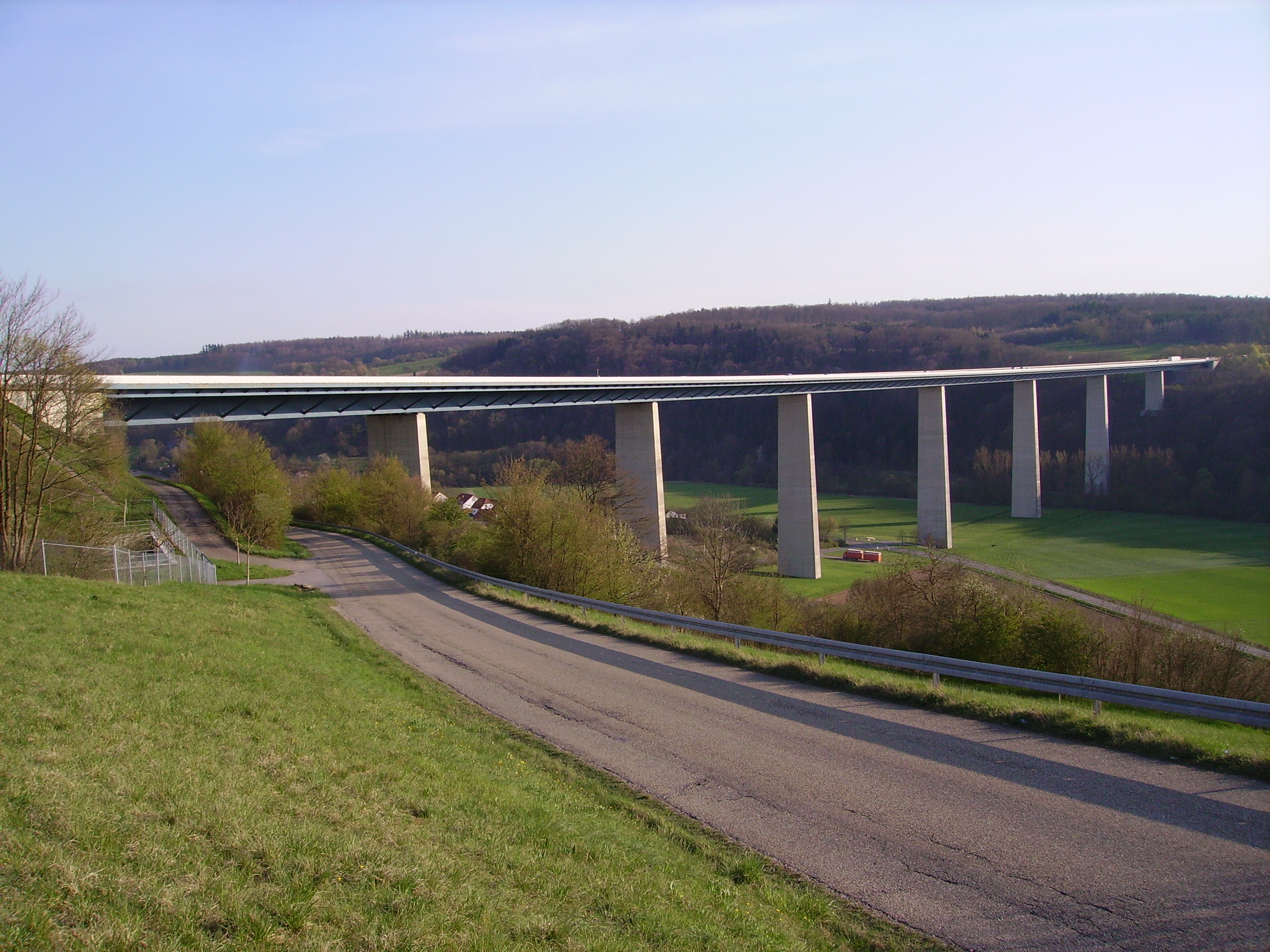
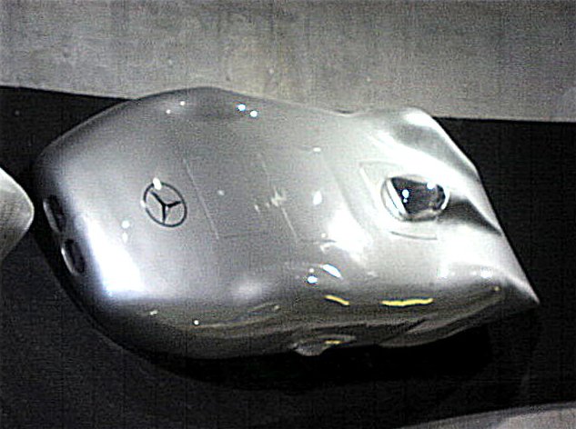
Driving away from the Frankfurt airport in a rental car after a transatlantic flight has its challenges. After negotiating the improbably narrow (at least by US standards) and twisting bowels of the rental car garage one is disgorged directly into fast-moving German traffic, necessitating instant decision making in order to get on the correct Autobahn. For much of the way south the Autobahn is entrenched in the sands of the Rhine Valley, hiding from view the castle-crowned hills of the Odenwald to the east. This is the same stretch of interstate where in 1938 race car driver Rudolph Caracciola broke the world speed record, reaching 432 km/hr in a Mercedes.

MHV_MB_12_Zyl_Record_Car_1938
Rudolph Caracciola’s record-setting Mercedes.

Those expecting to race at unlimited speed in this part Germany will be disappointed. Accelerate. Construction zone. Accelerate. “Stau” (bumper-to-bumper traffic). Stau. Stau. This is what happens when you have 81 million people living in a country smaller than the state of Montana.

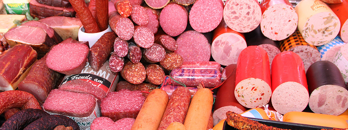
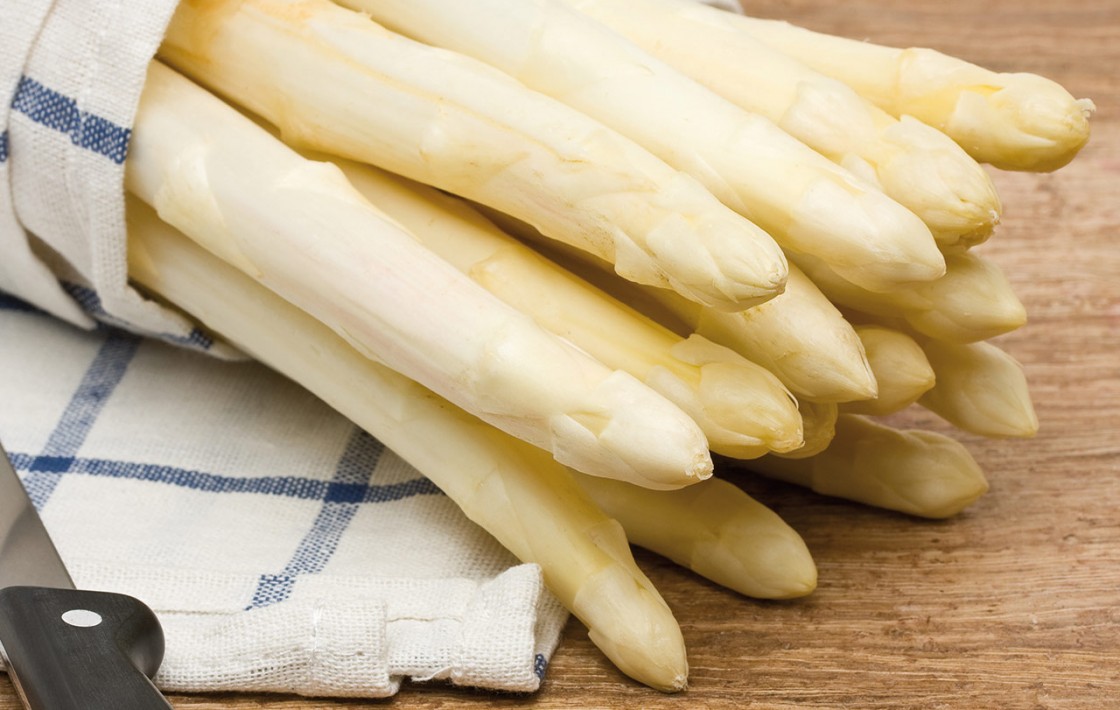
Pure stands of pale-trunked Scotch Pine give way to corrugated farm fields of white asparagus. Unlike its green cousin, white asparagus develops completely underground in long, heaped rows of soil. The lack of sunlight prevents the growing stalks from photosynthesizing and turning green. The delicate stalks must be harvested by hand with a special knife just as they begin to emerge from the soil. This part of the Rhine valley is the epicenter of white asparagus cultivation. The vegetable is served as a side dish with butter, with hollandaise sauce, is sometimes fried, and often found on pizza.

spargel-1120x710
White asparagus.

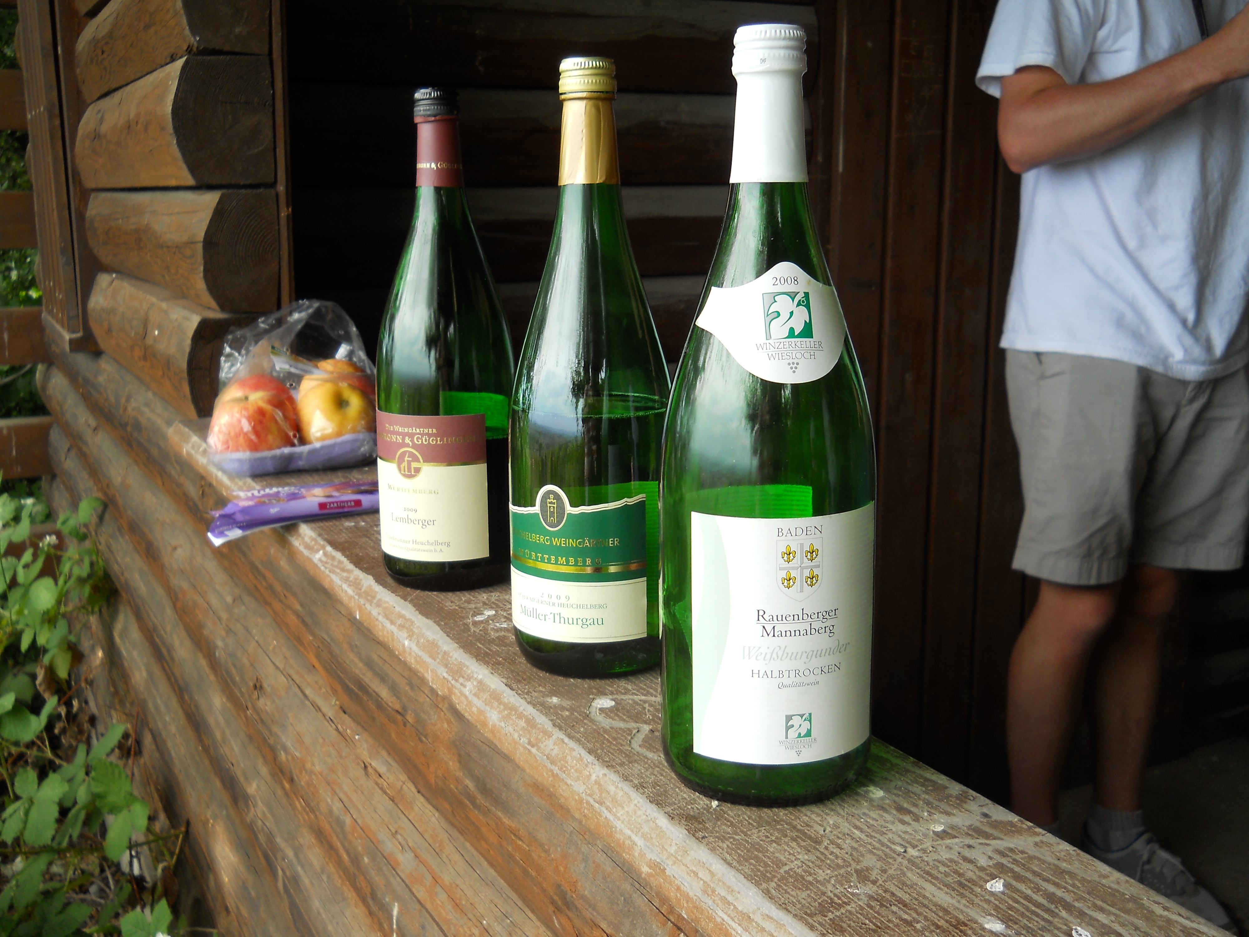
I was ready for lunch. In the town of Wiesloch I stopped at my aunt and uncle’s house for a visit and lunch of white asparagus, ham, potatoes and hollandaise sauce. I risked a second glass of Mueller-Thurgau wine, hoping it would break my jet lag. Mueller-Thurgau is the second-most planted white grape in Germany after Riesling. A genetic cross between Riesling and Madeleine Royale grapes, it is perhaps the most misunderstood and under-appreciated wine on the planet.

winebottles
Mueller-Thurgau (center). A favorite of Germans and of my students.

Germans appreciate its ability to grow in substandard soil and its 4 – 6 Euro/bottle price tag. It was the consistent favorite of my students during long, parching hikes through the countryside.

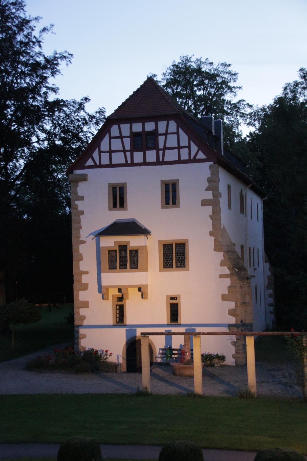
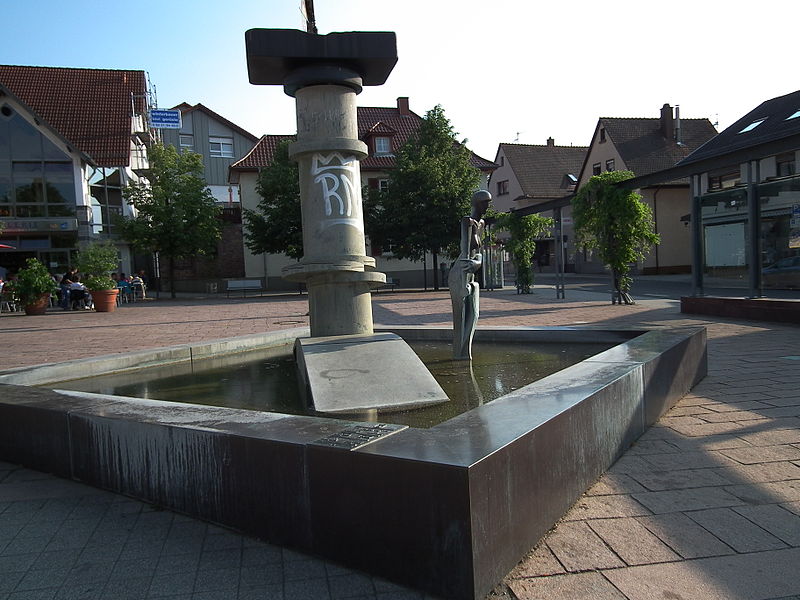
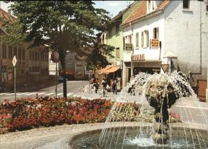
Later in the afternoon I drove a few kilometers to the neighboring town of Nussloch, which straddles the slope of the eastern Rhine Valley. This is the town where my ancestors on my mother’s side lived for hundreds of years, where I attended grammar school off and on, and where I still posses a couple of small orchards. It is also the German town that lost its soul. With the exception of the small 18th century Lutheran church, there is very little that is old in the town. Nothing that speaks of the past or an identity. All the half-timbered houses are gone and only a very few old barns remain in town, with their red sandstone blocks filling in the spaces between the wooden framework. The last few decades have seen entire old neighborhoods replaced with modern buildings, shops and a retirement home. All towns in this region have a nickname for either the place or its residents. The inhabitants of Nussloch were referred to as the “moon sprayers”. As the story goes, one evening in 1911 the fire department rushed to the scene of a reported forest fire, only to find it was a fiery moon rising on the horizon. The delightful moon fountain, that for years stood at the town center, was replaced by a cold statue of an abstract figure standing in a pool next to what appears to be a pipe.

800px-Brunnen_Nußloch_Lindenplatz
New fountain.
800px-Nußloch_Mondspritzbrunnen_2011
Former fountain in town center.

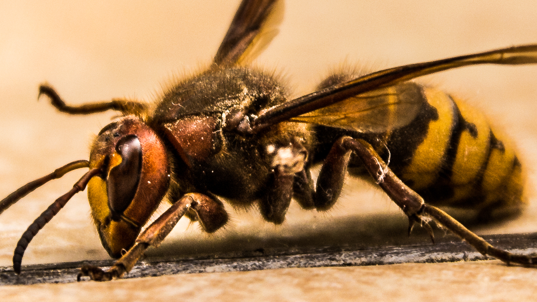
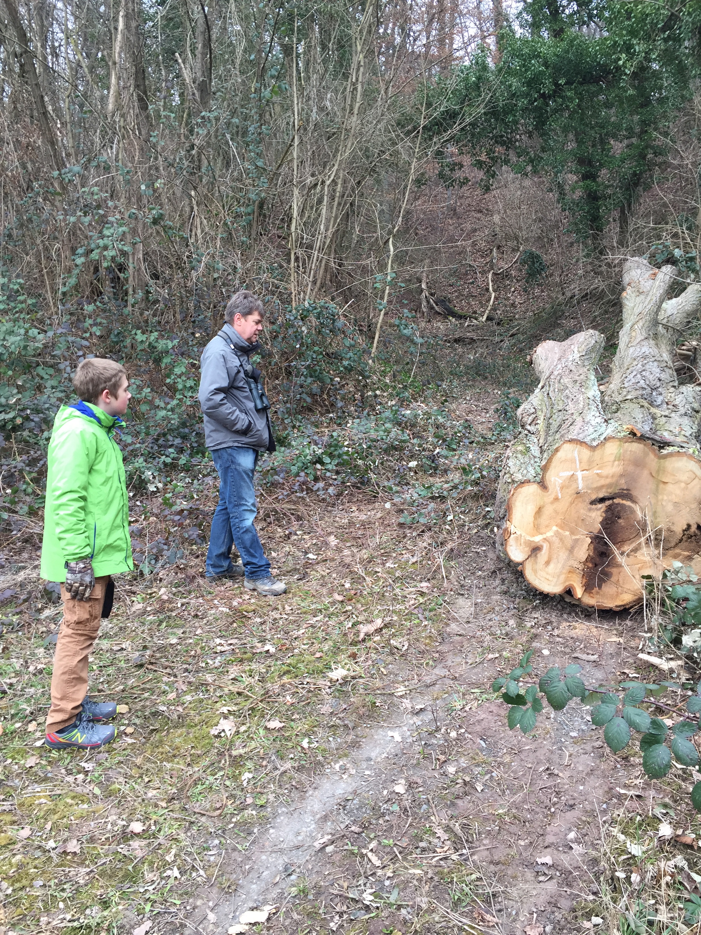
In Germany significant natural features such as landmark trees or small patches of forest of special ecological importance are often granted “Naturdenkmal” – natural monument – status. A few months before my arrival controversy surrounded the the town’s cutting down of its only Naturdenkmal tree, a large Linden planted in 1871 to mark the end of the Franco-Prussian war. Many towns have such “Peace Lindens.” It was the halfway point between my grandmother’s house and our family vineyard. My uncle often pulled us children in a wagon to the vineyard, with the familiar routine of “everybody gets out and walks at the Linden tree.” Standing beneath the tree in summer you could hear the faint droning of thousands of bees in the canopy overhead.
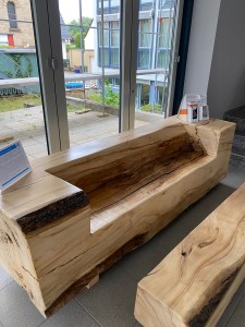
IMG_0055
Remains of the “Peace Linden.”

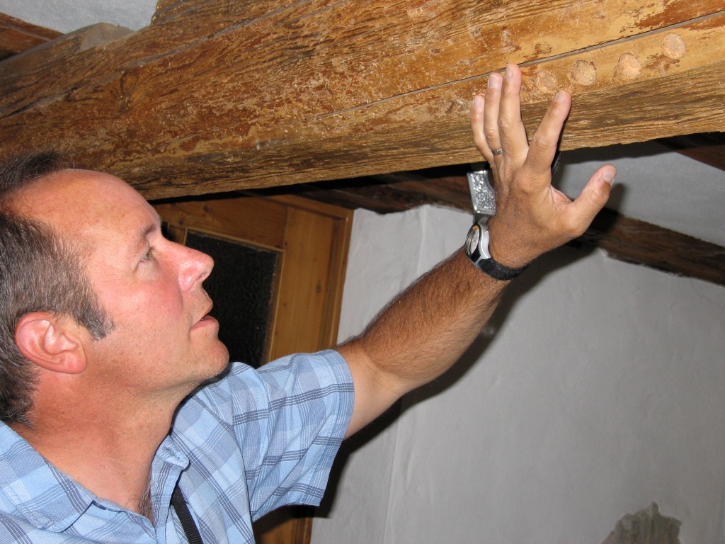
Much of the loss of the old buildings was beyond the immediate control of the town’s inhabitants. In early 1945, the town was subject to damaging allied air attacks. When American troops entered the town that spring, they showed their displeasure at one of the streets being named “Adolph Hitler Strasse” by commencing to destroy every other house along it. Only the protestant priest’s pleas stopped this plan from being completely carried out. All told, 59 houses were destroyed. It was on this street that I stayed the night at a tavern, spending the evening packing all the clothing, toiletries, first aid kit and rain gear I would need for the next six days.


Day 2 – April 29: Into the Kraichgau

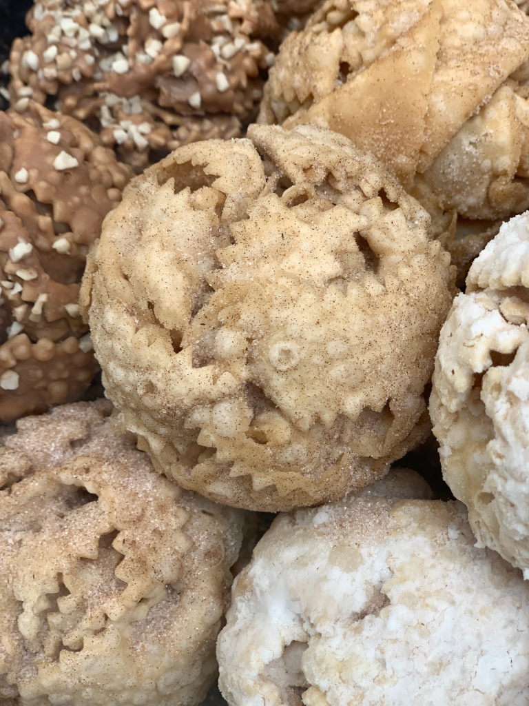
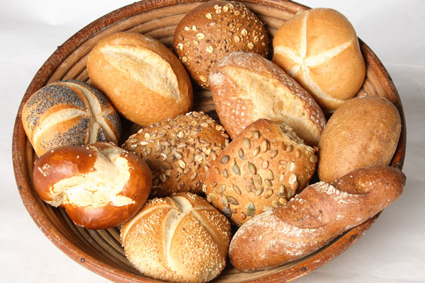
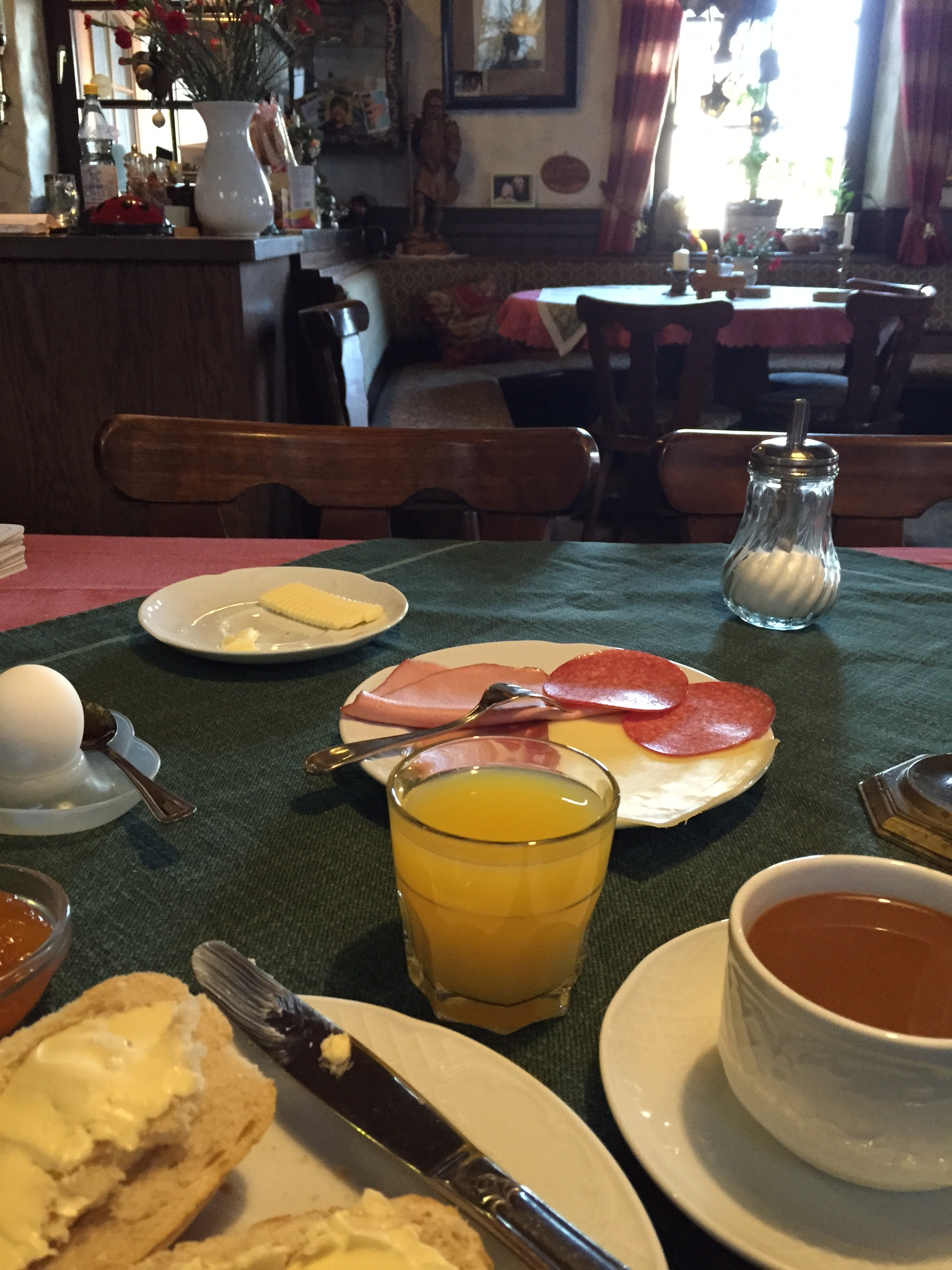
Every good day in Germany begins with Broetchen, the breakfast rolls made in the early morning hours of each day by the local baker. They are made in an endless variety of size, shape, grain combination, and coating. No wonder that as children, we had to be quiet on our street as our neighborhood baker and his wife napped between 1 and 3 p.m. each day to catch up on their sleep.

broetchen--original

IMG_0195
Tavern breakfast in Nussloch.

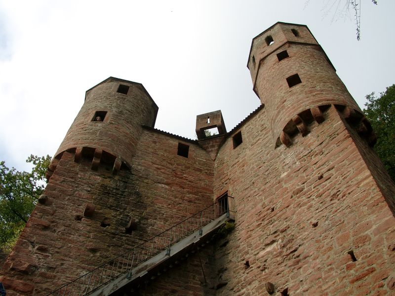
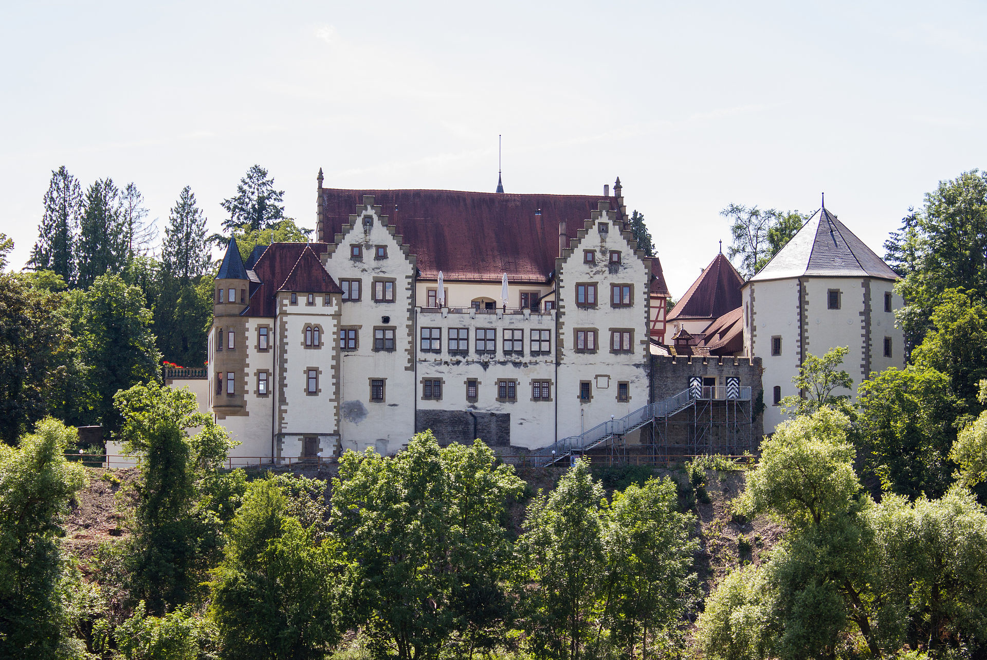
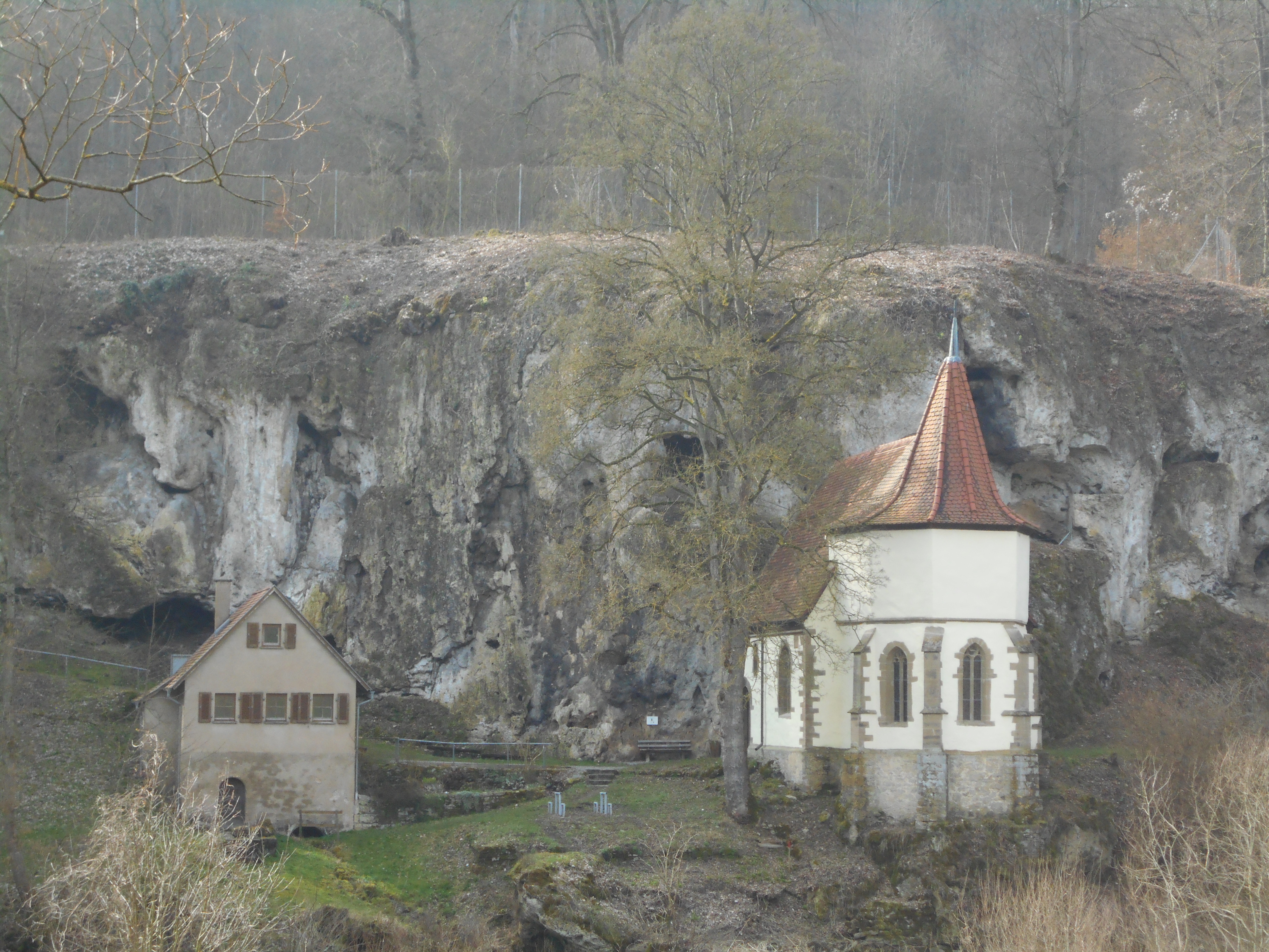
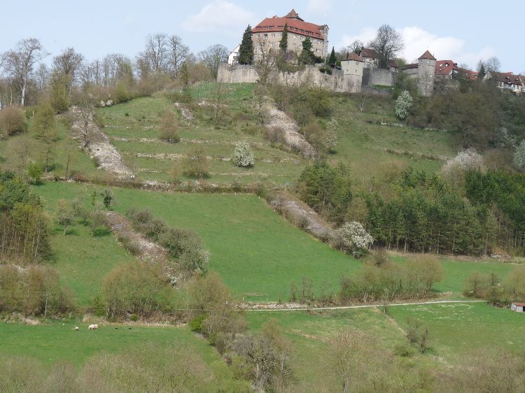
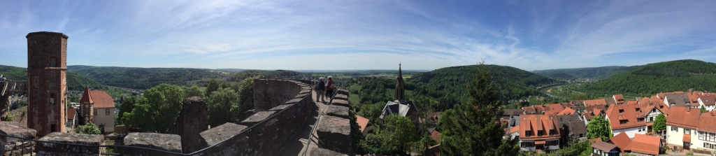
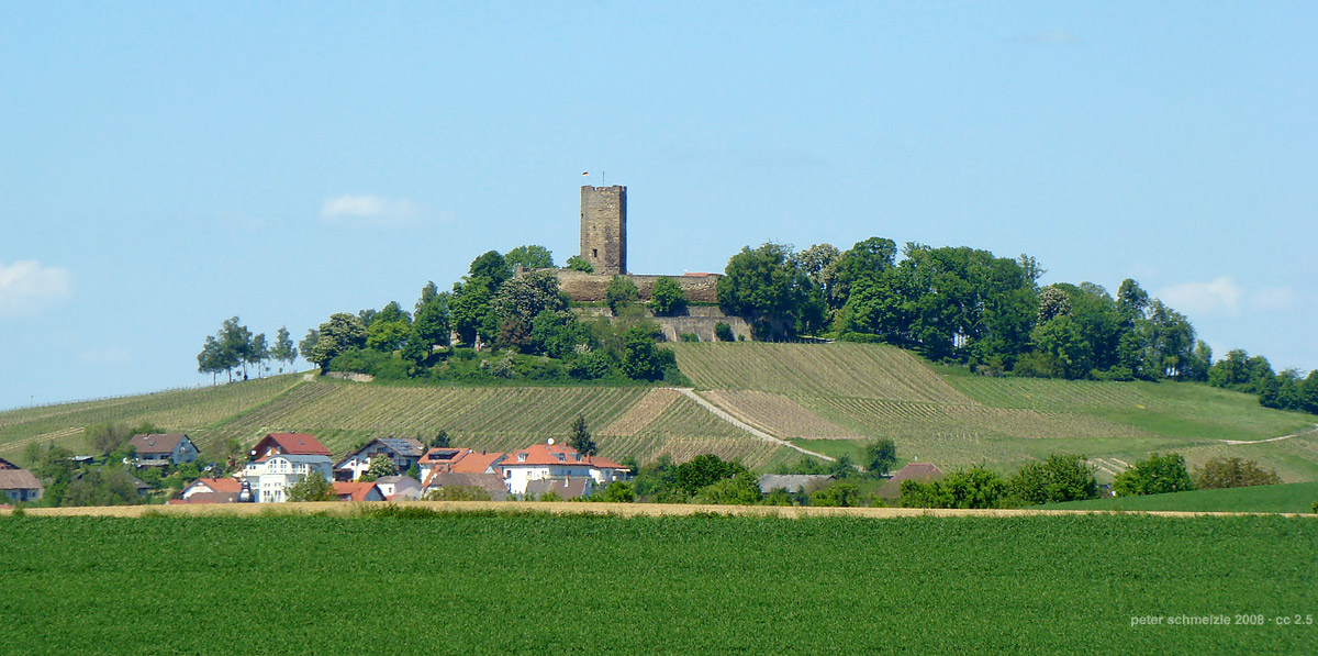
After breakfast in the tavern I drove back to Wiesloch to park the rental car at my aunt’s house, shouldered my pack, said goodbye and headed east up the street that would lead me out of the Rhine Valley and into the rolling hill country of the Kraichgau. The area above Wiesloch is the easiest way to access the Kraichgau, since the Rhine Valley’s edge is less elevated here than to the north or the south.  Soon I was off the asphalt, making my way through the fields and hedgerows along a farm track. The sky was a blue cap above. Behind me on the western horizon I could see the Vosges Forest rising dark behind the silhouette of the cathedral spires of Speyer on the Rhine Plain. To the north the Kaiserstuhl marked the beginning of the higher terrain north of the Kraichgau near the city of Heidelberg. Situated like a lighthouse on a hill to the south was the medieval fortress of the Steinsberg, often referred to as the “compass of the Kraichgau” since one can orient oneself from any point within view of it. The fortress is dominated by a tall stone tower, built atop the ancient remanent of a volcanic plug. It would be my companion for at least the first few days of my hike.

Sinsheim-steinsberg
The Steinsberg – compass of the Kraichgau.

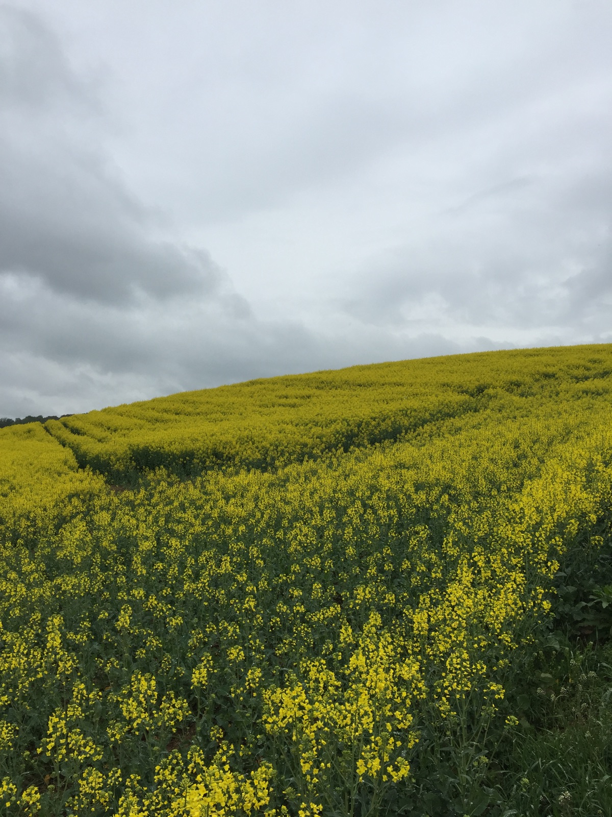
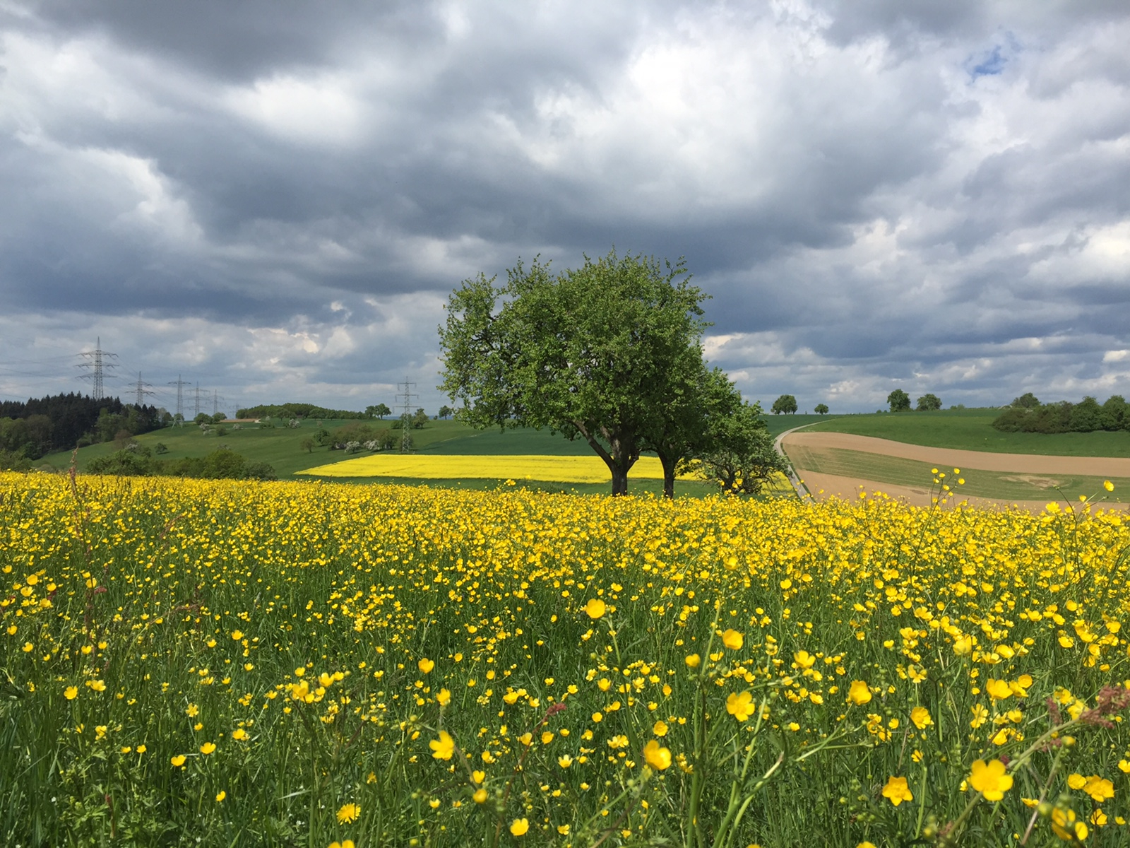
I had hit an exceptional bloom time. Apple and pear trees were in full blossom. Buttercups and rapeseed painted the fields yellow. The wheat – and the stinging nettles – were about knee high. Later in the season the nettles would tower over the wheat.

IMG_5933
Pear trees bloom alongside rapeseed. My way through the Kraichgau.
IMG_0221
Buttercups.

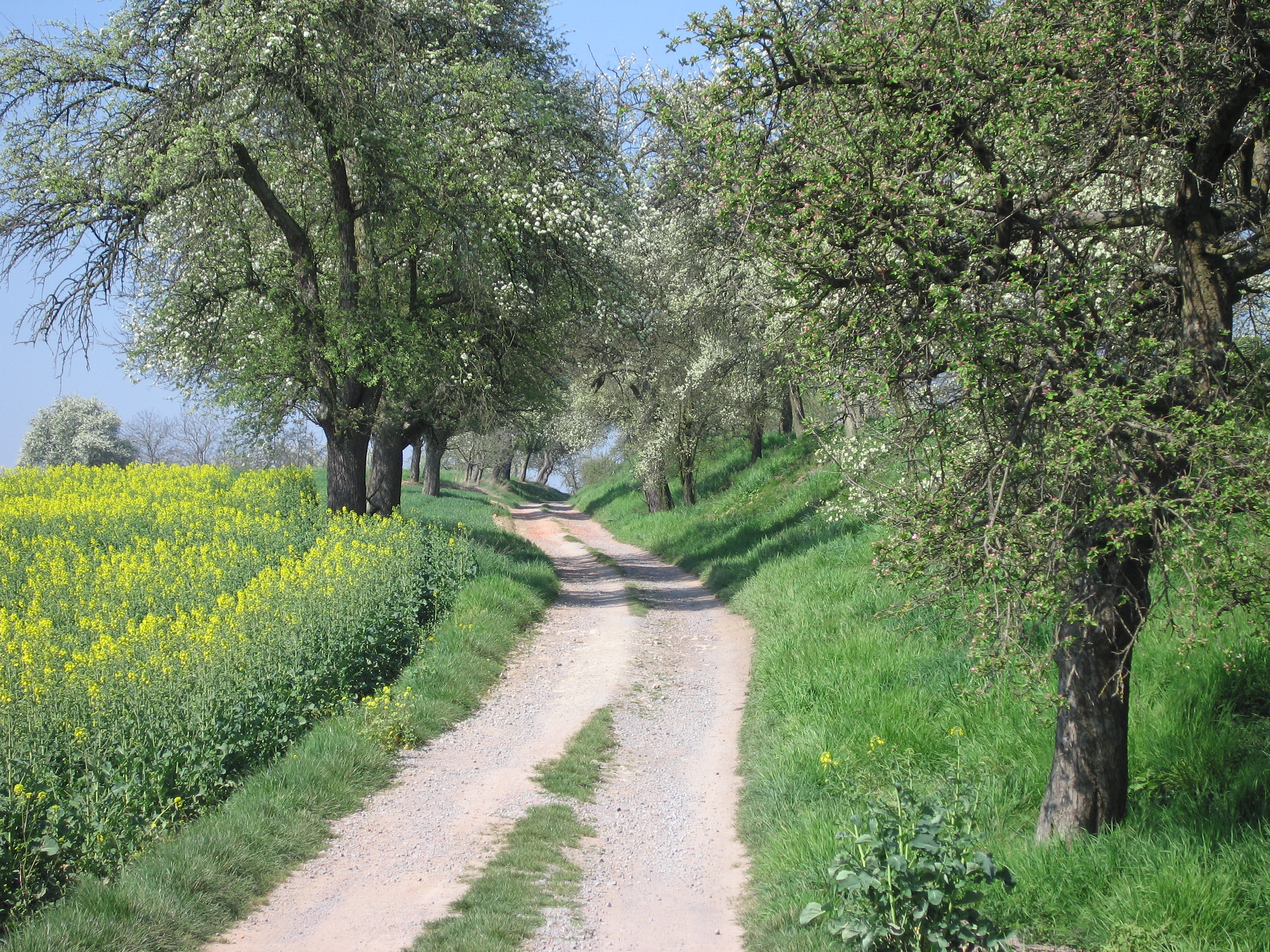
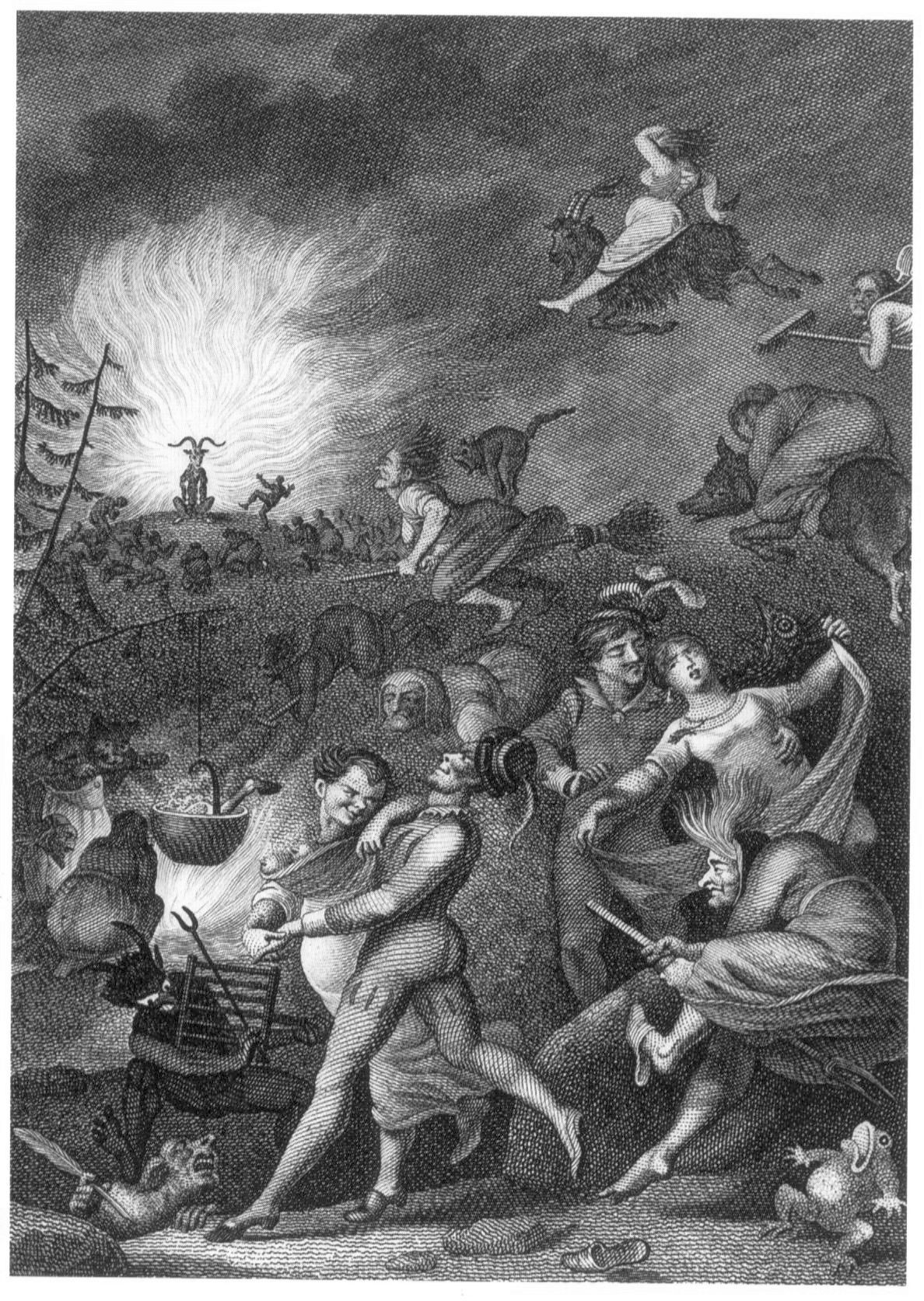
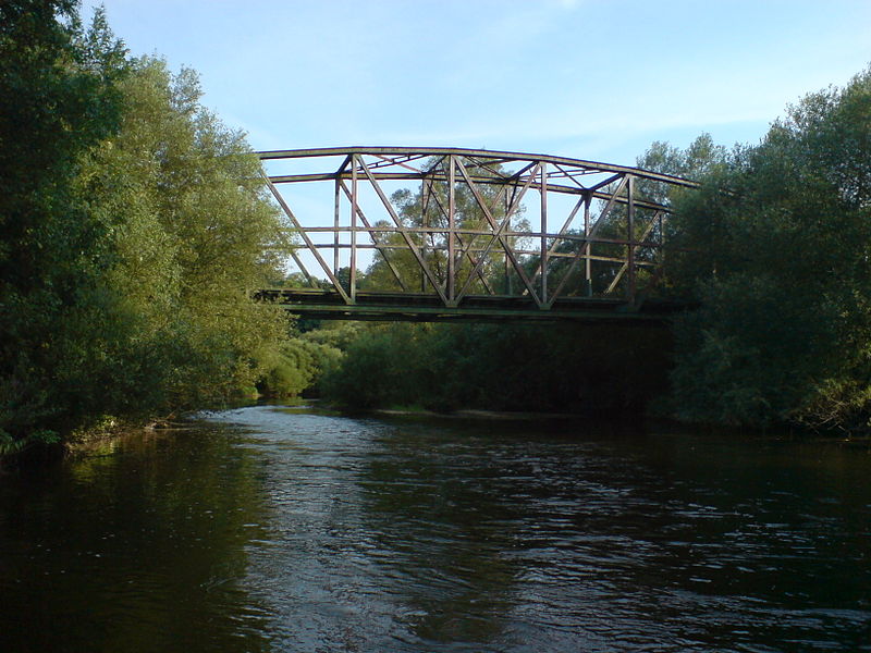
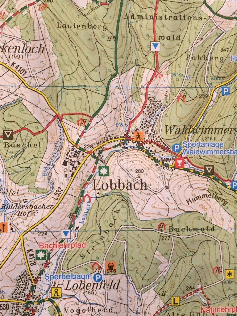
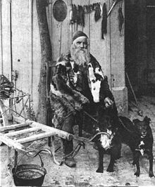
The Kraichgau is often referred to as Germany’s Tuscany because of its mild climate and mosaic of agricultural fields, orchards, vineyards, small towns and forests superimposed on a topography of rolling hills. To me it has always been a bit more mysterious, with its deep, shadowed sunken roads marking the path of medieval travelers – a bit more what I imagined the Shire of Tolkien’s works to be like. During my years as a child in Nussloch, my grandmother told tales of a dwarf named Gajemaenndl, who lived in a sunken road in the forest above town. Rarely glimpsed, he secretly helped wood cutters load wood if he deemed them good people, but played mischief with those of lesser moral integrity. My way now takes me through a sunken road towards the town of Zuzenhausen, where ancestors on my father’s side once lived and where an excellent brewery sits on the banks of the Elsenz, the Kraichgau’s largest stream. I’m only about halfway through my hike for the day but can’t resist a good glass of dark beer named Dachsenfranz (“Badger Franz”), named after a shadowy inhabitant of the local forests during the late 19th century until his disappearance during the first world war. He had fled his home country of Italy during the second independence war and made a home in the Kraichgau trapping badgers, martens and foxes. He sometimes worked for farmers and millers, ridding their buildings of mice and rats.

220px-Dachsenfranz_1900-1901
Dachsenfranz, circa 1900.
hohlweg
Students at entrance to a sunken road (Hohlweg).

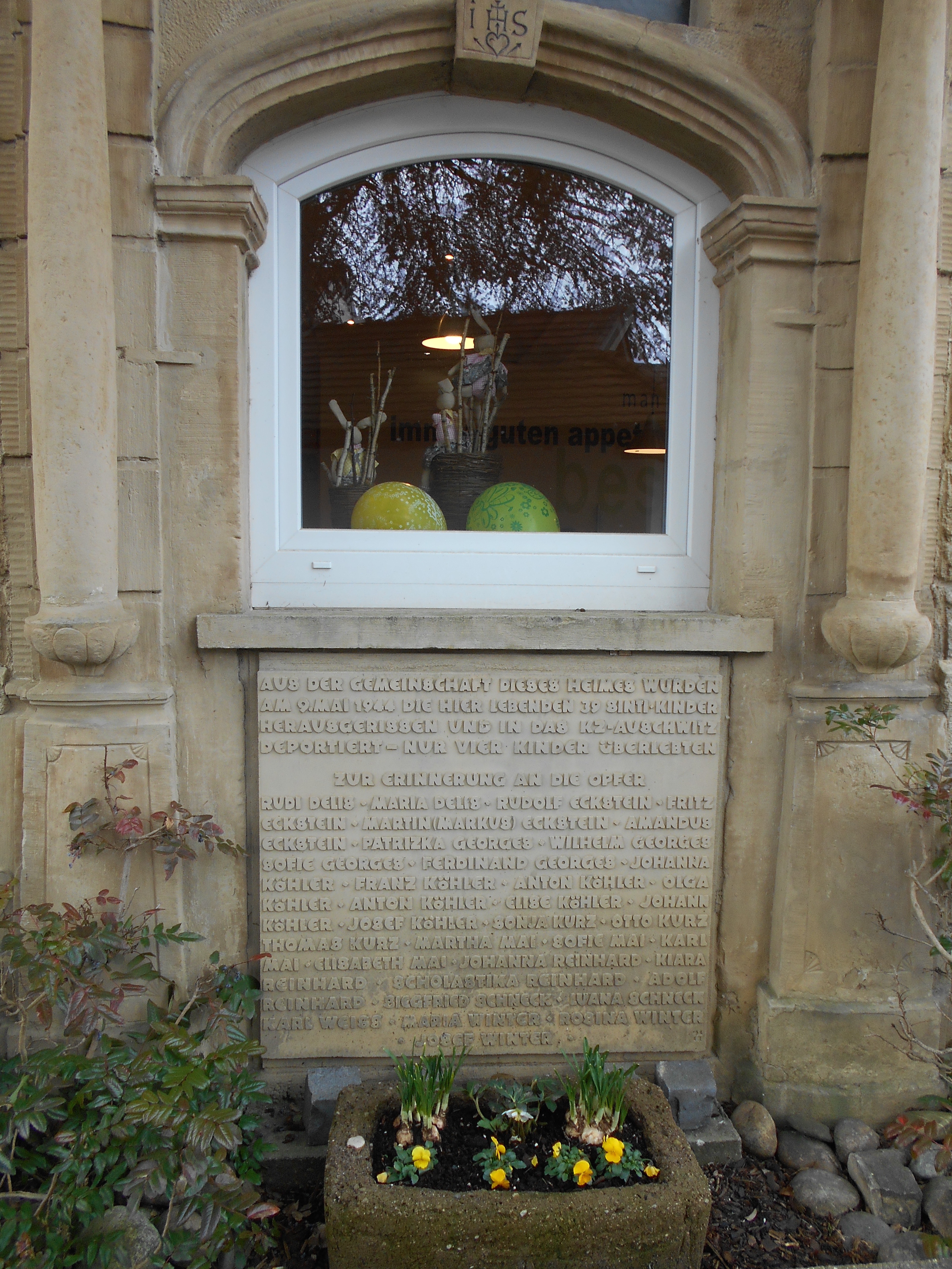
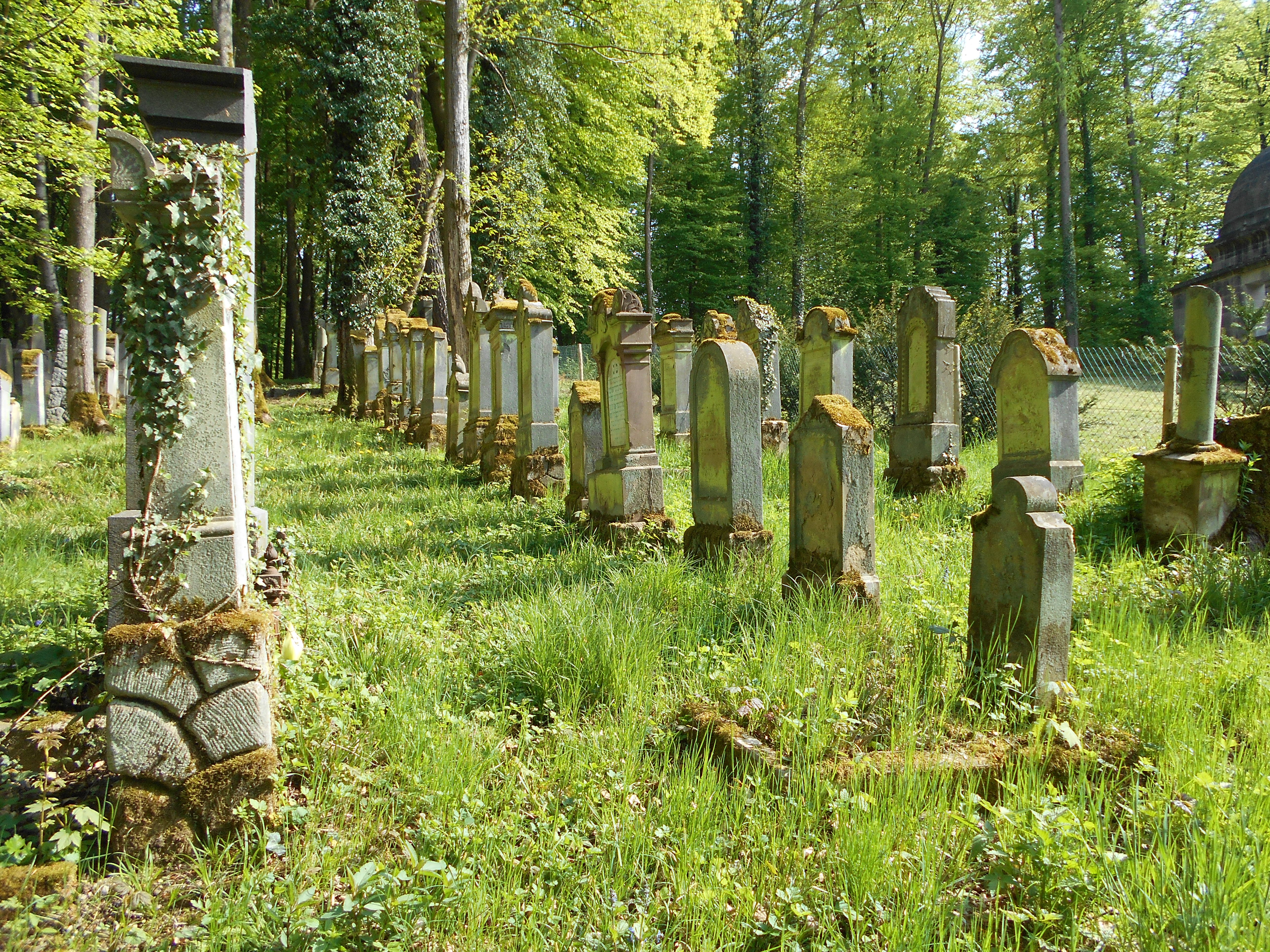
Later in the day I crest a hill and encounter a stone monument recounting the death of two young German aviators during world war 2, who died as their plane experienced “inadvertent contact with the ground.” Just outside of Waibstadt I pass by a large Jewish cemetery and mausoleum. The name of Weil is prominently inscribed across the front of the large structure. Hermann Weil established one of the world’s largest grain exchanges in Buenos Aires in 1889, later settled in Frankfurt before his death and burial here in 1927. His ashes, and those of his pre-deceased wife, were done away with during Kristallnacht in 1938.

DSCN0701
Jewish cemetery near Waibstadt. Weil mausoleum at right.

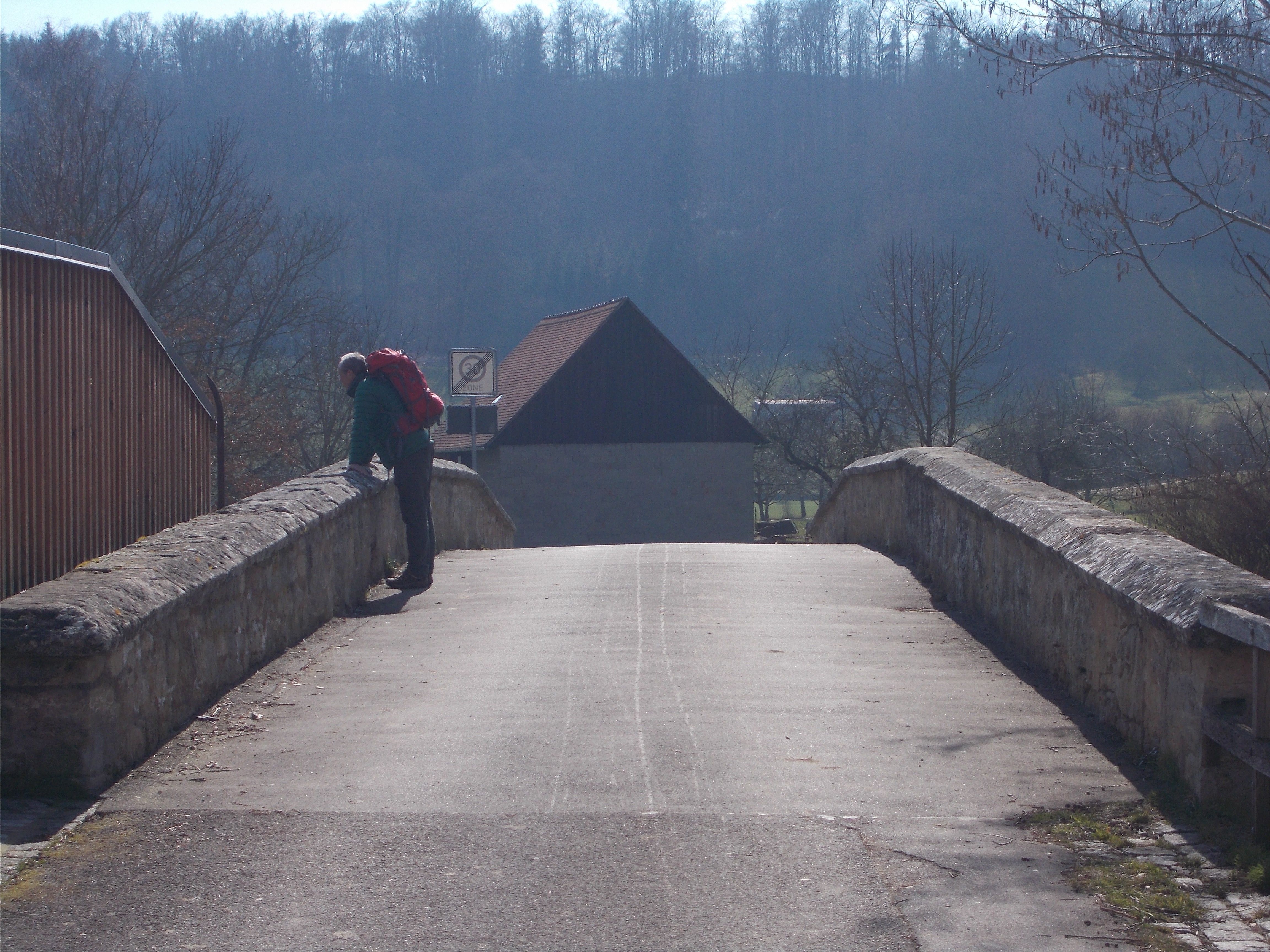
Finally in Neckarbischofsheim I cross the tiny Krebsbach and make my way to the hotel. The first 17 miles of my journey felt good. No blisters or other ailments. Tomorrow I would have the company of two cousins for the day. Towns passed through: Wiesloch-Baiertal-Oberhof-Zuzenhausen-Daisbach-Waibstadt-Neckarbischofsheim. Streams crossed: Leimbach-Elsenz-Krebsbach. To be continued on next post…


Rothenburg Pilgrimage

Journey into the Heart of the German Countryside – Part 2 (continued from previous post)

Day 3 – April 30: Over the Neckar River

My room in the castle hotel was at the quiet end of a long narrow wing of the early 19th- century structure. The only sound all night was the creaking of wooden floorboards as I made my way to and from the bathroom. The smaller, but more historic, 14-century palace was visible from my window as a completely separate structure. During renovations in the 1970s, Renaissance wall paintings were uncovered there.

schloss-neckarbischofsheim
The 14th-century Palace at Neckarbischofsheim.

After breakfast I sat on a bench in front of the hotel and waited for my cousins Peter and Patricia, who would join me for the day’s hike. A sign outside a bakery across the street advertised “Coffee Togo.” Another Americanization gone wrong. English terms have a long tradition of creeping into all aspects of German culture. I recently noticed the suffix “Arizona” on meat labels in butcher shops, apparently indicating a pre-seasoned, spicy disposition. Among the huge variety of cold-cuts there are recently added, healthier sounding varieties like “wellness” and “sport”.

wurst
“200 grams of wellness salami, please.”

My cousins arrive and we head east out of the Krebsbach valley onto the rolling hills of the Kraichgau. Peter is the head of a local environmental society and his knowledge of plants, geology, local history and especially birds, runs deep. He is a collector of most things and his large basement in his home (his “museum”) is crammed with thousands of slides, rocks, lamp shades, antiques, etc. His most treasured collection includes dozens of historic paper hole punchers used throughout history , but only in the state of Baden-Wuerttemberg. Patricia is his younger sister and prefers a more typical, uncluttered and immaculately clean German household. A repo-woman by trade, she takes her hiking and photography seriously. As we walk and reminisce about our families in the old days, the fir-covered sandstone hills of the Odenwald to the north come into view, with the extinct volcano of the Katzenbuckel (Cat’s back) forming a prominent knob. It came to life some 60 million years ago when Africa rammed into Europe, cracking the crust and enabling magma to bubble up to the surface. Nearby is the small Odenwald town of Finkenbach where, in the late 1970s, my cousins and I made a trek to the town’s annual, multi day open-air rock festival. The main attraction was the band Guru Guru, whose music is described by critics as psychedelic drug-influenced Kraut rock. Germany’s answer to the Grateful Dead. We recall that by the time we got there the main field by the stage was full of hippies and other assorted Odenwald freaks, so we made our way to the far end, where the field suddenly formed a steep slope upwards. Hippies camping in curved-roof gypsy wagons (hard-topped Conestogas) had cordoned this area off to make a children’s playground for festival attendees’ kids. I try to be considerate. “Hey man, can we sit back here?” I ask one of the hippies. He’s wearing a sleeveless denim jacket with a home-made design on the back consisting of a smiling sun ringed with the words “Atomkraft, was sonst? (nuclear power, what else?).” The two side-by-side letter s’s  are made to look like Waffen SS lightning bolts. “You can until the “Ordner” ( somebody who keeps order) arrives, and then you all have to leave!” is the answer delivered with a condescending sneer. I watched the hordes of festival goers streaming by me invading the playground area. “Fuck the Ordner.” The hillside offered a good view and dry real estate above the muddy field. A bottle of Old Kentucky Rifle soon washed away any feelings of guilt or worries about the hippy verger that never materialized.

Emerging from the forest we drop into a stream valley and enter the village of Wollenberg, where chestnut trees seem to have been planted in every courtyard among the old houses. These trees were much favored as plantings in beer gardens because their deep shade cast over cellars kept the drink cool. 19th-century poet Conrad Ferdinand Meyer wrote the beautiful poem “Black-shadowing Chestnut” that still begs for a proper translation into English.

200-jahre-biergarten---lebensfreude-unter-kastanien-image_620x349
Blooming chestnut trees shade a beer garden.

Bending northwards the land begins to fall steeply towards the gorge of the Neckar River. An old farm, the Finkenhof, overlooks the gorge. Just a few feet to the side of one of the farm lanes is a large pyramid of sandstone which serves as the burial marker of a duke who founded the farm. In this area of the Kraichgau most monuments, castles, and barns are made of blocks of the Buntsandstein (Colorful Sandstone). This dark red sandstone was formed 245 million years ago as sand grains were deposited in an ancient river system. Further to the north the present-day Neckar River has carved deep cliffs into the rock, which are often topped with small medieval fortresses.

30285194
Burial pyramid at the Finkenhof.
burg-schadeck-04
The Swallow’s Nest – One of many fortresses along the Neckar River made of Buntsandstein.

In this area the Neckar valley is bounded by the slightly younger limestone of the Muschelkalk Formation, which was deposited in an ancient ocean on top of the Buntsandstein. We switchback our way down through the limestone towards the Neckar River. Here, along the western bank, are several gated tunnels leading into the side of the mountain.  The soft gypsum found in the limestone in this area made the tunneling easier. The tunnels were used in 1944 – 45 during the Nazi’s “Operation Goldfisch”, which involved moving the airplane motor manufacturing facilities of the Daimler/Benz Company into the tunnels to provide protection from Allied aerial bombardments. Thousands of concentration camp prisoners from the nearby camp at Neckarelz were used as forced labor, spending long stretches of time underground. Peter tells me they were marched daily from their camp across the river via a bridge to the tunnels in plain view of the inhabitants of the area – yet after the war none claimed to remember this. In fact, it wasn’t until the 1980’s that the nearby town of Mosbach decided to research and  chronicle the concentration camp and former production facilities in the tunnels. Hundreds died during their time in the tunnels, in the camp, and during a forced march to a different camp near war’s end. After the war most of the equipment was given to Russia as war reparations.

Moertelsteiner_Tunnel_20060701
Entrance to one of the many tunnels used during “Operation Goldfisch”.

In the town of Obrigheim we pause and drink coffee, watching the Neckar River barge traffic drift downstream or labor upstream against the current. A series of 27 locks built on the Neckar in the 1920’s and 30’s now make it possible for barges over 100 meters long to travel more than 200 km upstream from the river’s confluence with the Rhine. Prior to this ships were either pulled by horses or pulled themselves along a submerged chain attached to the floor of the river. The lock structures have also partially dammed the river, making it wider and flooding out rapids that once posed an obstacle to boat traffic. The river was different when Mark Twain saw it in 1878. Suffering from writer’s block, he came to Heidelberg and the Neckar Valley for a change of scenery. He hiked from Heidelberg to Heilbronn and returned partly by boat, providing an account of his journey in A Tramp Abroad. His raft trip down the Neckar is pure fiction, but served as inspiration for Huckleberry Finn. Twain reported that “The Neckar is in places so narrow that a person can throw a dog across it, if he has one; when it is also sharply curved in such places, the raftsman has to do some pretty nice snug piloting to make the turns.” The rafts he mentions were made of floating lumber cut in the Black Forest. The flooding on the Neckar was also known to Twain: “A hatful of rain makes high water on the Neckar, and a basketful produces an overflow.”

Rafting on the Neckar
“Rafting on the Neckar” from Twain’s A Tramp Abroad.


hc-mark-twain-travel-0315-20150312
Twain’s Neckar raft trip was pure fiction, but the idea served as inspiration for Huckleberry Finn.


We cross the Neckar along with rush hour traffic making its way between Mosbach and Obrigheim and quickly find the trail that takes us up the steep hill of the Schreckberg on the other side. This is a sun-baked slope formed in a part of the Muschelkalk known as the Wellenkalk (“Wavy Limestone”). The contorted layers were formed when earthquakes deformed soft sedimentary layers of lime mud on the ancient seafloor. The dry, hot slope of the Schreckberg is famous for its biodiversity of grasshoppers. In fact, it has the only signed educational path in Germany dedicated solely to grasshoppers.

Nachtigallgrashuepfer
The Nightingale grasshopper perched on limestone of the Schreckberg.

Near dark we reach Peter’s house in Mosbach where I’ll spend my second night. After a wonderful dinner cooked by Peter’s wife Petra I head to my bedroom. My feet feel strange. I take off my boots (guaranteed to not cause blisters) and see a hideous sight. Blisters bigger than any I can remember from the Appalachian Trail. Nothing for it but to pop them and hope for the best. Another strange sensation manifests itself – rawness between my upper thighs. Nothing in my first aid kit will work on this. No Gold Bond or duct tape! I shower and drop off to sleep – tomorrow is the longest day of the trip. Distance hiked: 17 miles. Towns hiked through: Neckarbishofsheim, Wollenberg, Kaelbertshausen, Obrigheim, Diedesheim, Mosbach. Streams crossed: Krebsbach, Wolleb, Neckar River.

To be continued in next post…..


Rothenburg Pilgrimage

Journey into the Heart of the German Countryside – Part 3 (continued from previous post)

Day 4 – May 1: Along the Jagst River

A classic rotten night’s sleep. All night I was haunted by the realization that tomorrow would be the longest leg of the hike (25 miles) that would have to be accomplished with the worst blisters I ever had and the chaffing between my thighs. To make matters worse, I was periodically awakened by the sound of rain on the roof window above my head. Once or twice I heard the voices of passing revelers in the street below on their way home from Walpurgisnacht celebrations in meadows on the hillsides above town. Their spirits were not dampened by the weather. Walpurgisnacht is also known as Hexennacht (Witches’ Night) in German folklore. On this night witches gathered atop the Brocken, the granite-crowned highpoint in the Harz mountains of central Germany, to await the dawn and coming of summer. Today Germans celebrate the night with bonfires, drum circles and drink.

Walpurgisnacht
Witches cavorting on the Brocken during Walpurgisnacht. From an 1829 engraving by Johann Heinrich Ramberg.

There is an especially large gathering of torch-bearing celebrants each Walpurgisnacht on a hilltop outside of Heidelberg at the Thingstaette, one of about 45 amphitheaters built by the Nazis for theater presentations and propaganda displays.

Menschenmenge_beim_Tanz_in_den_Mai_2007_auf_der_Heidelberger_Thingstätte_001
Walpurgisnacht celebration at the Thingstaette in Heidelberg. Photo by Andreas Fink.

I knew that on this evening in the largest German cities like Berlin and Hamburg, anarchists would be creating their own bonfires by setting automobiles alight. This tradition, along with breaking storefront windows and battling police, dates back to May 1, 1987 when left-wing radicals rioted against what they called a “bourgeois” celebration of the 750th anniversary of the founding of Berlin.

Before dawn I get a text from Peter asking if I want coffee or tea. We leave the house before seven, Peter acting as my guide through the town. In the grey dawn the old medieval core of the town is completely deserted and quiet, as if a recurrence of the plague had taken everyone away. After passing through several narrow back alleys we climb out of the Elz valley, a small tributary of the Neckar that has cut a deep notch into the landscape in which Mosbach sits. The path twists upwards past small orchards, finally taking us through a spinney before cresting on the relatively level, open upland above Mosbach. This is the Bauland, an agricultural plain slightly higher and more level than the Kraichgau. It forms a triangle of land between the Neckar River and its tributary that I am now making for, the Jagst.

Slide1
Map showing section of my hike along the Jagst River (Mosbach-Moeckmuehl- Krautheim-Mulfingen-Rothenburg).

After walking with me for another hour Peter heads back home. Low dark clouds pass quickly above and drop a gentle but steady drizzle throughout the morning. Enough rain to warrant a rain jacket, broad-brimmed hat and pack cover, but not rain pants. The first of May is a national holiday in Germany. A day when people take to the fields and forests on long walks, often pulling a small wagon loaded with beer behind them. There are numerous town festivals with brass bands and cooked Bratwurst beneath Maypoles. I was happy the weather had kept the hordes in their beds and houses today. As I dropped down a fold in the land towards the village of Sulzbach I heard snippets of music from a brass band carried my way on the wind. Anticipating a big town festival I was surprised to see only a small band playing in the light rain, dutifully and uncovered, to no one.

My plan now was to leave the marked trail, thereby cutting off a big loop to the north and saving significant time. This meant walking across fields with faint paths in wet, waist high grass. I was getting hungry and began looking for any dry place to sit for a few minutes. I decided to climb up into a wooden Hochsitz, or deer stand, of the kind that are seen all across the German countryside. This one was completely enclosed, had a carpeted bench, and a long, narrow plexiglass window that could be flipped up for shooting. I was happy to have the lunch Peter insisted I take along, since I had originally planned to eat at one of the nonexistent Mayday festivals. This high seat proved to be an ideal spot until I heard a faint buzzing behind my head. I turned slowly around to see four European hornets making a nest on the wall of the deer stand. As quickly as I could I packed my things and made my escape. These hornets are up to two inches long have a wicked sting. I hadn’t forgotten the time my father was stung on the head and knocked off a ladder by one. They invaded Tennessee several years ago. I suppose that’s only just since we gave Germany the Black Locust tree, a species I have a constant battle with both in my yard in Tennessee and in my orchard in Germany.

European-Hornet
The European Hornet – Vespa crabro.

I continued on in the hopes of finding a bratwurst in the next town. The drizzle continued and brought out the depths of color of the tree trunks, Rapeseed and wheat.

IMG_3989
Rapeseed in the rain.

Before dropping down into the Jagst Valley I pass by numerous Streuobstwiesen (literally “strewn fruit meadows”). Some translate this term into English with the unromantic phrase “traditionally managed orchards”. These are small orchards of heirloom variety pears, apples, apricots, plums and the like that are strewn across the landscape of the Bauland and the Kraichgau (the name does not derive from the fact that the fruit often lies strewn uncollected beneath the trees, as many falsely believe). Many of the trees have been pruned so that their first branches only appear at shoulder or head height above the ground. The grasses beneath the trees are let to grow tall and are often only cut once per year with a scythe. In recent years there has been an effort to preserve these icons of the German landscape.

DSCN0274
My son collecting heirloom apples in a Streuobstwiese.
IMG_1389
Cutting grass with a scythe.

By early afternoon I come to the edge of the Bauland where the land drops down sharply into the Jagst River valley. It is still drizzling but the sight of the fortress tower and defensive city wall in Moeckmuehl below draws me on. This is a large town – surely there is a sizable Mayday festival with food there. Soon I was making my way through the newer portions of the town which had crept up onto the sides of the Jagst valley. Two neighbors spoke to each other from their windows: “Aren’t you going walking today? You bought all that beer!”. “Hell no, shit weather”. No sound of any band and no throngs of people in the old town – but, the smell of food cooking outside was promising. I turned a corner and found the source of the good scent. A barbecue hosted by the Turkish – Islamic Friendship Society, which involved about seven or eight young men running in and out of a building tending a grill under the eaves of a roof in the rain. This didn’t look open to the public – especially not Americans. The rainy slog went on through the small town of Ruchsen. The trail took me back up the side of the Jagst Valley and beneath a huge bridge carrying the Autobahn A81 (80 meters high by 880 meters long). Whereas in the US  we tend to let the interstates follow the land contours somewhat, in Germany they love to construct massive bridges right across all valleys. As I approached the bridge I quickened my pace, nervous about being struck by some projectile launched from a passing car above. The complete lack of any litter on the ground was reassuring – this certainly was not Tennessee.

KONICA MINOLTA DIGITAL CAMERA
Jagst Valley bridge.

Back down in the Jagst Valley the trail followed the extreme meanders of the river. The rain began to intensify and hit me at an angle from the front. I tilted my head down, the brim of my hat limiting my view to a few feet of ground ahead. Large snails, of the kind eaten by the French, crossed my path (easy to avoid) along with hundreds of small, shell-less types (hard to avoid) that all seemed to be going in the same direction. I was tired and from the waist down a walking display of ailments. The last meander loop between Olnhausen and Jagsthausen, my stopping point for the night, seemed to drag on forever. Finally I arrived at my destination in the center of Jagsthausen, the fine tavern Krone (the Crown). After checking into my room and taking a shower I headed downstairs for an excellent meal and good dark beer. Back in my room I fell asleep instantly, in spite of the sounds of a man snoring in the room next door. Distance hiked: 25 miles. Towns hiked through: Mosbach, Sulzbach, Billigheim, Moeckmuehl, Ruchsen, Widdern, Olnhausen, Jagsthausen. Streams crossed: Elz, Sulzbach, Schefflenz, Seckach, Jagst River, Hergsbach.

Rothenburg Pilgrimage

Journey into the Heart of the German Countryside – Part 4 (continued from previous post)

Day 5 – May 2: Shadows of the Past

By most measures the Jagst is a small river. Along its 126 mile length one can throw a rock across it in most places. But it is an old river, having carved its valley deeply down into the limestone of the  Hohenlohe Plateau for hundreds of thousands of years. It witnessed the coming and going of ice ages, had mammoths and bison drink from its waters, and buried with its sediment Neanderthals, Celtic swords, Roman oil lamps, medieval ironmongery, and Wehrmacht weapons. Some relics endure as impressive structures, such as the pilgrimage church of St. Gangolph’s that was built in the 13th Century on the northern side of the Jagst River valley. Other relics come to light by chance or through archaeological excavation.

DSCN0806
A doorway to St. Gangolph’s church in the Jagst valley. This 13th Century pilgrimage church honors Gangolph, the patron saint of horses and springs.

I leave the tavern early in the morning and round a corner in downtown Jagsthausen, passing a block where the remains of a Roman military compound have been excavated. This 2nd Century compound was one of several placed at intervals along the Limes, the fortified boundary of the Roman empire at that time. The Limes ran across the Jagst valley here, extending up and over a ridge into the neighboring valley of the Kocher River. The compound also contained a bath complex of several rooms, so that the bather could move first from a cold water bath (frigidarium room) to a warm water bath (tepidarium room) and finally to a hot water bath (caldarium room). This bath complex was adorned with two statues of Fortuna, the goddess of good fortune.

DSCN0820
A statue of the goddess Fortuna from the Roman baths in Jagsthausen.

In the clear morning I cross the Jagst via a small bridge. Looking back at Jagsthausen I can now see the impressive medieval castle that belonged to the legendary Imperial Knight Goetz von Berlichingen (1480 – 1562).

DSCN0314
Crossing the Jagst River.
Götzenburg_Jagsthausen_Hintere_Ansicht
The former residence of Goetz von Berlichingen in Jagsthausen.

Goetz owned several fortresses along both the Jagst and Neckar Rivers and was involved in several military engagements (feuds, sieges, and mercenary actions) including the Peasants’ Revolt in 1525. During a battle in 1504 a cannonball struck his sword, which swiveled and cut off his right arm. He survived the injury and was famous for using an iron  prosthetic arm from that time on. Hence his familiar title “Goetz with the iron hand.” The poet Goethe wrote a play about Goetz’s life. In the third scene Goetz is under siege by the Imperial Army in his castle at Jagsthausen when a messenger of the army asks him if he will surrender. From a castle window Goetz gives his famous answer: “Tell your captain he can lick my arse.”

220px-Götz-eiserne-hand1
Goetz’s iron prosthetic.


Around a meander bend of the Jagst I pass through the town of Berlichingen, another former residence of Goetz, and another bend brings me in sight of the spectacular Baroque Schoental Abbey. The structure began as a Cistercian monastery in the 12th Century, but was rebuilt as a Baroque structure after extensive damage and decay during the Peasant’s Revolt and Reformation. This is Goetz von Berlichingen’s burial place. I tried to find his grave, but there was a wedding in progress in the abbey church and each of my footfalls seemed to reverberate through the entire interior.

DSCN0828
Interior of Schoental Abbey church.

I closed the immense church door as quietly as possible and snuck down the front steps. Back on the Jagst floodplain my path paralleled an abandoned narrow gauge railway. Many of the passenger wagons seem to have just been left on the tracks, now covered with vines and grown through with saplings. This 39 km-long railway was built around 1900 to transport people and freight along the river. After a slow decline in use the system was relegated to the  transport of sugar beets up until 1988, when the entire line was abandoned. Recent attempts to resurrect a part of the line were shot down by voters in the area, who noted the very high costs associated with the project (over 500,000 Euros).

800px-Jagsttalbahn_Winzenhofen
Old railway bridge across the Jagst near the town of Winzenhofen. (Photo by Olof Hreioarsson)

Over the next several kilometers I notice a peculiar pain in my left upper shin. It feels as if a tendon is acting up. I periodically massage it and find myself taking more frequent rests, sitting on benches and rock walls. Suddenly something seems to snap, as if a tendon has detached and rolled up like a window shade (but from the upper shin down). There is a strange, tender lump at the base of my shin. Miraculously I can carry on, as long as I don’t move my ankle and keep my foot straight. Up hill is better than down. This style of locomotion works, but gives me a distinctive limp. I would find out later from my sports orthopedist that I actually had a stress fracture.

At Altkrautheim (Old Cabbage Home) the trail leaves the Jagst floodplain and rises up the valley flank to the edge of the forest. There is a small memorial marker to three German soldiers killed during the last few days of World War II. It is only a few days away from the 70th anniversary of the end of the war in Europe (May 8, 1945). During those last desperate days for the Wehrmacht U.S. forces pursued the Germans eastward across the Jagst River. The Germans destroyed the Jagst bridges to slow the progress of the Allied forces and in the maelstrom of war atrocities were committed on both sides. These usually involved the execution of prisoners. During battles along the Jagst, 41 members of the 17th SS Mechanized Infantry “Goetz von Berlichingen” were murdered after their capture by U.S. troops.

In the woods alongside the trail accumulations of flowstone cover the slopes. Here acidic rainwater has entered cracks in the limestone of the Muschelkalk, dissolving it and re-precipitating it as wave-like, layered rock on the slopes of the valley. A bit further upstream I pass the largest mass of flowstone along the entire river, which forms an impressive 10 meter high wall. The pilgrimage chapel St. Wendel zum Stein was erected in the early 16th Century in honor of Saint Wendelin, patron saint of shepherds. It is the third chapel built here, the first having been built in the 6th Century A.D. above the present chapel. The legend of the place is that a shepherd discovered a treasure here and as thanks to God erected the first chapel. Its traces are still visible. In 1936 a cave was discovered here that contained skeletons, tools, coins and amber beads from Celtic tribes  of the Hallstatt Culture (8th to 6th Centuries B.C.).

DSCN0834
St. Wendel zum Stein hugs a 10 meter high wall of flowstone along the Jagst.

The trail takes me through the woods above the cliffs of St. Wendel zum Stein. I can hear a brass band playing in the distance and I encounter more and more people (mostly families) along the way. Clearly a festival of some sort is taking place in the woods. Suddenly I’m at an opening in the trees filled with throngs of people and huge tents selling wine, beer and bratwurst from the grill. This is a welcome sight. I drink a glass of Riesling and watch children attempt to climb a 30 foot high wooden pole to get at prizes suspended from the top. The whole endeavor looks dangerous. No safety net,  ropes, or cushions at the base of the pole. Not even parents spotting their own children as they attempt the climb. It seems as if there’s not much to worry about, as no child makes it higher than head-height or so. Suddenly an athletic (clearly a gymnast) girl of about 8 years makes her way surely and skillfully up the pole. At the top she reaches out far with one arm to dislodge a toy that she wants. It falls to the ground and she slides back down the pole. I breathe a sigh of relief. Feeling rejuvenated from the wine I move on. My goal of Ailringen is only about 2 km away, but I can barely make it. I sit on a bench with the town just across the river. My wife calls. I’m too spent and in too much pain to talk. Finally I cross a bridge to the hotel. The Altes Amtshaus in Ailringen is luxurious. After a dinner of lamb and red wine I rest on my bed in my bathrobe, contemplating my legs and feet – then drift off to sleep.

IMG_0255
A restorative dinner in the Altes Amtshaus, Ailringen.

Distance hiked: 21 miles. Towns hiked through: Jagsthausen, Berlichingen, Kloster Schoental, Bieringen, Westernhausen, Winzenhofen, Marlach, Altkrautheim, Klepsau, Doerzbach, Hohebach, Ailringen.

Journey into the Heart of the German Countryside – Part 5 (continued from previous post)

Day 6 – May 3: The Sinti Children of Mulfingen

Upstream of Ailringen the Jagst Valley becomes narrower and steeper than in its downstream reaches. This is due to the fact that the river here is embedded in the upper Muschelkalk limestone, which has fewer shale beds in it and is therefore more resistant to weathering than its lower portions exposed downstream. All along the slopes there are narrow bands of piled up limestone blocks that border old vineyards, now mostly abandoned and overgrown. Already in the Middle Ages people had attempted to improve the vineyards by removing all exposed rocks and piling them into linear walls called Steinriegel. Exposed to the sun, these rocks absorbed the heat  during the day and re-radiated it at night, thus providing a more favorable microclimate in the vineyards.

__BIG__TP_BGL9_10_27
Steinriegel, linear rows of limestone blocks like these shown in the neighboring Kocher River Valley, line old vineyards and fields along the slopes of the Jagst Valley as well.

Coming around a bend on my approach to the town of Mulfingen I encounter a group of 15 people about to embark on a hike. Their leader is a geology professor from a local university. Amused to find like-minded folk I tag along with them for about an hour as they inspect the geology in a small tributary valley of the Jagst. A woman in the group has noticed my limp and offers to drive me to my destination which is still some 15 kilometers away. I’m tempted, but tell her that I’ve got to hike every inch to Rothenburg if I can.

With a population of less than 4,000, Mulfingen is the biggest town I will see today until I reach my destination of Blaufelden in the evening. All towns in this part of Germany have near their center a small open space with benches and perhaps a few trees and an old fountain. Historically these spots served as a market and festival place on the main road through town. Mulfingen has such a space. It is bordered on one side by a large, multi-storied yellow building with large letters in green, orange and red at its front spelling out the name “St Josefspflege”. Teenagers run, some with cell phones in hand, towards the front door. This institution has, since  1976, served as a center for children with learning differences. But from its founding in 1854 until 1976 it served as a Catholic orphanage, with the Sisters of Untermarchtal responsible for the upbringing of the children. Before and during World War II it was the site of one of the most disturbing chapters in the Jagst Valley’s history.

DSCN0838
St. Josefspflege in Mulfingen, a former orphanage and site of one of the most disturbing chapters in the history of the Jagst Valley.

Here, between 1938 and 1944 all Roma and Sinti children from the state of Baden Wuerttemberg were interred for ethnic studies by the Nazi regime. The Roma and Sinti peoples, often referred to as the Gypsies, arrived in Germany in the Late Middle Ages from India. Until more recently they often lived a peripatetic lifestyle on the periphery of established communities. The Nazis considered them racially inferior.

In Mulfingen the children were the subject of study by the anthropologist Eva Justin, who was using her observations to finish her doctoral dissertation. The title of this dissertation: “Biographical destinies of Gypsy children and their offspring who were educated in a manner inappropriate for their species”, leaves no doubt about her complicity in the crimes committed against the Sinti and Romani peoples. She actively lobbied for sterilization of Gypsies. The children lived relatively happy lives at the orphanage, amused at being filmed by Justin for what reason they did not know. However, after Justin had completed her dissertation and therefore no longer needed the children, plans were made to deport them. On May 9 of 1944 buses arrived at the entrance to the orphanage. The children were excited to learn that an outing had been planned for them. While getting on to the buses police arrived to oversee the event and the older children, who now guessed the real reason for the trip, broke into a panic. Several of the Catholic Sisters were sent on the buses to reassure the children. The supposed outing was actually deportation to the Gypsy camp at Auschwitz, where they arrived on May 12, after a circuitous 3-day journey that involved hiding from Allied air strikes. During their journey they were moved to a train and the escort was taken over by soldiers of the Waffen SS. Once at Auschwitz they were reunited with other Sinti children that had formerly lived in Mulfingen. The children were initially interred in Block 16, but then those under the age of 14 were housed in a separate children’s block. 4 of the older children were selected for manual labor duty, which would ultimately ensure their survival. The other 35 were either subjected to Josef Mengele’s cruel medical experiments or sent to the gas chamber on the night of August 3, 1944. The images of the children captured on film by Justin during happier times (shown above) at the orphanage are both haunting and disturbing. Standing outside the orphanage I can almost hear the echoes of their muffled laughter and running feet. Incredibly, Justin was never held accountable for her part in the horrible deaths of these children. She even found employment as a psychologist with the Frankfurt police department after the war. She died in 1966. Today a plaque in memory of those children stands outside the former orphanage, and their story is an important part of today’s curriculum at St. Josefspflege.

DSCN0836
Memorial plaque for the 39 Sinti children deported to Auschwitz on May 9, 1944.

Several kilometers south of Mulfingen I reach the village of Eberbach. It is time for me to leave the Jagst Valley and head east towards my final destination of Rothenburg. Here the Roetelbach stream has carved a narrow valley from the Hohenlohe Plateau to the east down towards its confluence with the Jagst.  Both sides of the narrow valley are forested and add to the darkness of an overcast day. It begins to rain and the gravel road paralleling the stream itself becomes a water conveyance. A green Mercedes SUV passes by slowly on its way down to the Jagst Valley, the driver giving me close scrutiny. No doubt he’s wondering what a person with a limp and a pack is doing on a remote track in the woods in this weather. Near the top of the valley I join the Hohenlohe Plateau at the site of the ruined fortress Hertenstein. This small stone structure was built in the 13th Century at the crossing of two important trade routes, offering protection to travelers. Within only 200 years it had been abandoned and fallen into ruin.

Now my leg is becoming very painful and I have serious doubts about making it to Rothenburg, even though it is only one day’s walk away. The green Mercedes returns, now coming uphill behind me. The driver stops and opens his window. “Can I give you a ride?” Keenly aware of my worsening leg I gladly accept, making the last few kilometers into Blaufelden in sublime ease. He is a hunter and was checking on his deer stands. The conversation encompasses my hike, geology, and his daughter’s college study in the United States. “Are you staying at the tavern Zum Hirschen? It’s the only place to stay in Blaufelden.” Soon I’m at the front door, feeling somewhat sheepish for not having knocked out the last few kilometers, but knowing I saved my leg from something worse.

Day 7 – May 4: Rothenburg

I hobbled up the front steps of the tavern only to find the door locked. Going around the back I almost ran into the proprietress, who didn’t expect me for another week. This was the one day of the week when the tavern was closed (a Ruhetag, or “rest day”). Turning on lights in the dark downstairs restaurant, she quickly worked out a guest room on the second floor and recommended a neighboring tavern for dinner. In my room I spread out the topographic map and considered what to do with the remainder of my journey. It was still 21 miles to Rothenburg, but I knew my leg was in too bad of a condition to walk that far. The way on the map looked boring – mostly open farm fields across the Hohenlohe Plateau with lots of zig-zagging necessary to make a connection of farm roads to Rothenburg. Yet there was a tantalizing narrow green finger of a valley extending from Rothenburg about 6 miles to the southwest back towards where I was in Blaufelden. I decided to arrange for a cab to drop me off at the top of this valley and hike the last 6 miles in to Rothenburg. Even though I wasn’t going to make the entire hike, at least I could still try to walk in the last bit.

The next morning the cab dropped me off in the small town of Bettenfeld at the top of the narrow, leafy valley leading to Rothenburg. I had just crossed the state line of Baden-Wuerttemberg and was now in Bavaria. Standing at the head of the valley I could see in the distance my goal, the medieval walled city of Rothenburg. An impressive site with its array of slender towers along the outer wall, set high above the Tauber River valley (hence the name Rothenburg ob der Tauber – Rothenburg above the Tauber). This was undoubtedly the same view that had impressed travelers approaching the city for the last 1,000 years. I dropped into the valley along the E8 hiking trail, which stretches almost 3,000 miles from Ireland to Bulgaria. Small signs with the clam shells posted at intervals reminded me I was on one of the official branches of an ancient pilgrimage route. The valley was carved in Muschelkalk by the Schandtauber stream, which would find its confluence with the Tauber River 6 miles away outside of Rothenburg. The majority of water in the stream comes from a cave opening at the top of the valley. The cave is the largest formed within this Muschelkalk layer in Germany. Soon the trail takes me past two pretty, half-timbered mills (Obermuehle and Mittelmuehle) along the stream, but then ascends again to pop me out of the forest onto farm fields of the Hohenlohe Plateau. I walk under a huge wind turbine that hums quietly. Like the mills, this device harnesses one of the basic elements to produce energy. After traversing young wheat fields the trail finally drops back into the valley of the Schandtauber, which has now grown from the addition of small tributaries. Yet another mill, the Hammerschmiede, sits stream-side and was once used to manufacture an array of tools.

The Hammerschmiede along the Schandtauber stream.

Over the next 2 miles the stream broadens before joining the Tauber River. At the confluence is a small, wooden covered bridge that takes me over the Tauber just upstream of the old walled city of Rothenburg.I haven’t caught a glimpse of the city since descending into the Schandtauber valley. Even now, being close enough to hear the din of traffic and voices somewhere above me I still see nothing of the great outer wall and towers. The trail begins to wind up the far side of the Tauber valley and suddenly I’m standing at the base of the towering city wall, looking for a gateway in.

Bridge across the Tauber River.
Standing at the base of the walled city of Rothenburg, looking for a gateway in.

I walk along the base of the wall for a couple of hundred yards before finding an entrance via the Spital gate. I limp through like a medieval leper. The street scene is jarring compared to the quiet countryside of the last week.

My way in.

Throngs of Asian and American tourists window shop along the cobbled street that leads gently upwards towards the marketplace at the center of the city. This scenario mirrors the vibrant street life that played out here since the early 13th Century, when Rothenburg began to thrive as a free imperial city. Butcher shop windows display a mind-boggling array of meats, bakeries tempt with mountains of pastries and medieval-themed shops offer tourists an array of swords, maces, morning stars, steel helmets, crusader’s tunics and local Bocksbeutel wine in the trademark teardrop-shaped bottles. An American teenager exits a shop wearing a newly-purchased medieval peasant’s dress, followed by a smiling, doting boyfriend.

Storefront of a butcher shop.

I can’t resist walking into a bakery to pick up a treat. Amidst the usual wonderful array of items American bakery products have begun to spread like invasive plant species. Muffins, cookies, donuts. I tell the woman behind the counter that I didn’t come all the way to Germany to eat American food. Amongst all the fare are some of the most beautiful to behold, but disappointing to eat bakery products native to Rothenburg. These are the baseball-sized, fried dough balls called Schneeballen (Snowballs) that are proudly displayed in every bakery window and that have all the appeal of a fried mass of cardboard. They have recently found their way to shops in Heidelberg.

Schneeballen in a Rothenburg bakery window.

A few paces later I sit in a beer garden for a quick half liter before heading to the St. James’s cathedral (St. Jacobs in German), an official stop on the pilgrimage route. In the queue to pay the entrance fee the attendant asks me “Are you a pilgrim?” I’m momentarily caught off guard. A realization hits me. “Yes, yes I am.” “Then there is no charge for you.” In the apse is the Holy Blood Altar, a 32-foot high wooden altar carved by Tilman Riemenschneider, the great northern renaissance sculptor. Near the top of the altar is a clear crystal that contains what is claimed to be a few drops of Jesus’s blood.

Detail from the Holy Blood Altar – the Last Supper.

Off the marketplace square I find my accommodations in a small, half-timbered bed and breakfast. In the lobby downstairs are a number of holes that have been drilled into the ancient floor joists of the second floor. These indicate where wood cores were retrieved for dendrochronological study.

Cores taken for dendrochronological study from joists in my B&B.

That evening I sit on my bed, rest my injured leg, and hear the news on television that the German rail workers have gone on strike. I was to take the train back to where I started in the morning. I call my cousin Peter in Mosbach, about a one and a half hour drive from me, to see if he can take me back. His first reaction is “Look, we had injured relatives that walked back to Germany from Stalingrad.” I can’t tell if he’s joking.

The next day Peter arrives and takes me back to my car at the place where I started my hike. I still have a week left in Germany- time I had hoped to spend doing more short hikes. Instead I settle into my small vacation apartment at the Dilsberg, a small medieval town set atop a hill overlooking the Neckar River. Luckily I have an amazing view from here and don’t regret having little else to do but convalesce and sample the local wine.

A few days later, May 7, is the 70th anniversary of Germany’s surrender in World War II. The day is clear and bright. I make my way to the parapet of an old castle near my apartment and look out over the landscape I had just walked across. Somewhere on the horizon, where things are blue and faint, is Rothenburg. I forget about my injury for the moment and start to think about a next hike….

View from the castle in Dilsberg. Neckar Valley to right, Kraichgau to the left.