
A Walk into the Heart of the German Countryside: Day 7, Rothenburg
I hobbled up the front steps of the tavern only to find the door locked. Going around the back I almost ran into the proprietress, who didn’t expect me for another week. This was the one day of the week when the tavern was closed (a Ruhetag, or “rest day”). Turning on lights in the dark downstairs restaurant, she quickly worked out a guest room on the second floor and recommended a neighboring tavern for dinner. In my room I spread out the topographic map and considered what to do with the remainder of my journey. It was still 21 miles to Rothenburg, but I knew my leg was in too bad of a condition to walk that far. The way on the map looked boring – mostly open farm fields across the Hohenlohe Plateau with lots of zig-zagging necessary to make a connection of farm roads to Rothenburg. Yet there was a tantalizing narrow green finger of a valley extending from Rothenburg about 6 miles to the southwest back towards where I was in Blaufelden. I decided to arrange for a cab to drop me off at the top of this valley and hike the last 6 miles in to Rothenburg. Even though I wasn’t going to make the entire hike, at least I could still try to walk in the last bit.
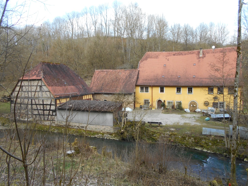
The next morning the cab dropped me off in the small town of Bettenfeld at the top of the narrow, leafy valley leading to Rothenburg. I had just crossed the state line of Baden-Wuerttemberg and was now in Bavaria. Standing at the head of the valley I could see in the distance my goal, the medieval walled city of Rothenburg. An impressive site with its array of slender towers along the outer wall, set high above the Tauber River valley (hence the name Rothenburg ob der Tauber – Rothenburg above the Tauber). This was undoubtedly the same view that had impressed travelers approaching the city for the last 1,000 years. I dropped into the valley along the E8 hiking trail, which stretches almost 3,000 miles from Ireland to Bulgaria. Small signs with the clam shells posted at intervals reminded me I was on one of the official branches of an ancient pilgrimage route. The valley was carved in Muschelkalk by the Schandtauber stream, which would find its confluence with the Tauber River 6 miles away outside of Rothenburg. The majority of water in the stream comes from a cave opening at the top of the valley. The cave is the largest formed within this Muschelkalk layer in Germany. Soon the trail takes me past two pretty, half-timbered mills (Obermuehle and Mittelmuehle) along the stream, but then ascends again to pop me out of the forest onto farm fields of the Hohenlohe Plateau. I walk under a huge wind turbine that hums quietly. Like the mills, this device harnesses one of the basic elements to produce energy. After traversing young wheat fields the trail finally drops back into the valley of the Schandtauber, which has now grown from the addition of small tributaries. Yet another mill, the Hammerschmiede, sits stream-side and was once used to manufacture an array of tools.
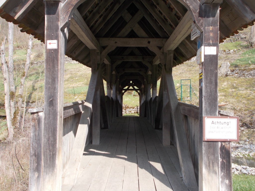
Over the next 2 miles the stream broadens before joining the Tauber River. At the confluence is a small, wooden covered bridge that takes me over the Tauber just upstream of the old walled city of Rothenburg.I haven’t caught a glimpse of the city since descending into the Schandtauber valley. Even now, being close enough to hear the din of traffic and voices somewhere above me I still see nothing of the great outer wall and towers. The trail begins to wind up the far side of the Tauber valley and suddenly I’m standing at the base of the towering city wall, looking for a gateway in.

I walk along the base of the wall for a couple of hundred yards before finding an entrance via the Spital gate. I limp through like a medieval leper. The street scene is jarring compared to the quiet countryside of the last week.

Throngs of Asian and American tourists window shop along the cobbled street that leads gently upwards towards the marketplace at the center of the city. This scenario mirrors the vibrant street life that played out here since the early 13th Century, when Rothenburg began to thrive as a free imperial city. Butcher shop windows display a mind-boggling array of meats, bakeries tempt with mountains of pastries and medieval-themed shops offer tourists an array of swords, maces, morning stars, steel helmets, crusader’s tunics and local Bocksbeutel wine in the trademark teardrop-shaped bottles. An American teenager exits a shop wearing a newly-purchased medieval peasant’s dress, followed by a smiling, doting boyfriend.

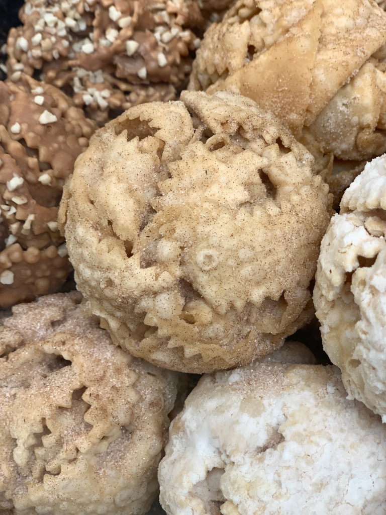
I can’t resist walking into a bakery to pick up a treat. Amidst the usual wonderful array of items American bakery products have begun to spread like invasive plant species. Muffins, cookies, donuts. I tell the woman behind the counter that I didn’t come all the way to Germany to eat American food. Amongst all the fare are some of the most beautiful to behold, but disappointing to eat bakery products native to Rothenburg. These are the baseball-sized, fried dough balls called Schneeballen (Snowballs) that are proudly displayed in every bakery window and that have all the appeal of a fried mass of cardboard. They have recently found their way to shops in Heidelberg.
A few paces later I sit in a beer garden for a quick half liter before heading to the St. James’s cathedral (St. Jacobs in German), an official stop on the pilgrimage route. In the queue to pay the entrance fee the attendant asks me “Are you a pilgrim?” I’m momentarily caught off guard. A realization hits me. “Yes, yes I am.” “Then there is no charge for you.” In the apse is the Holy Blood Altar, a 32-foot high wooden altar carved by Tilman Riemenschneider, the great northern renaissance sculptor. Near the top of the altar is a clear crystal that contains what is claimed to be a few drops of Jesus’s blood.

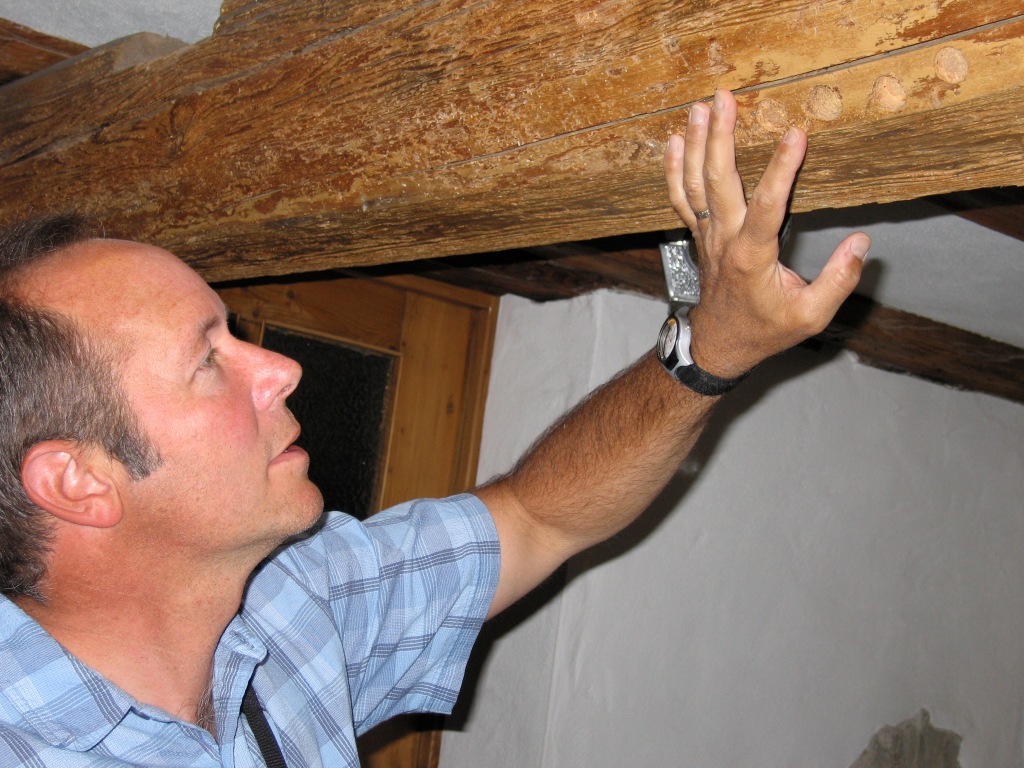
Off the marketplace square I find my accommodations in a small, half-timbered bed and breakfast. In the lobby downstairs are a number of holes that have been drilled into the ancient floor joists of the second floor. These indicate where wood cores were retrieved for dendrochronological study.
That evening I sit on my bed, rest my injured leg, and hear the news on television that the German rail workers have gone on strike. I was to take the train back to where I started in the morning. I call my cousin Peter in Mosbach, about a one and a half hour drive from me, to see if he can take me back. His first reaction is “Look, we had injured relatives that walked back to Germany from Stalingrad.” I can’t tell if he’s joking.
The next day Peter arrives and takes me back to my car at the place where I started my hike. I still have a week left in Germany- time I had hoped to spend doing more short hikes. Instead I settle into my small vacation apartment at the Dilsberg, a small medieval town set atop a hill overlooking the Neckar River. Luckily I have an amazing view from here and don’t regret having little else to do but convalesce and sample the local wine.
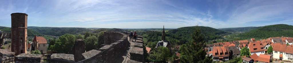
A few days later, May 7, is the 70th anniversary of Germany’s surrender in World War II. The day is clear and bright. I make my way to the parapet of an old castle near my apartment and look out over the landscape I had just walked across. Somewhere on the horizon, where things are blue and faint, is Rothenburg. I forget about my injury for the moment and start to think about a next hike….

Of course I was joking!
wasnt I?
War der Krieg nicht am 8. Mai erst aus, you wrote 7th
LikeLike
Lovely travel account! I’m going next month and can’t wait to retrace some of your steps!
LikeLiked by 1 person